J'ai pas trop le temps de regarder mais ca a l'air trés bien
ca me rapelle graphiquement le boulot de social computing ... :)
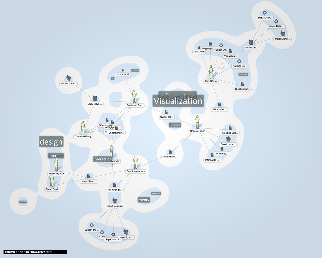
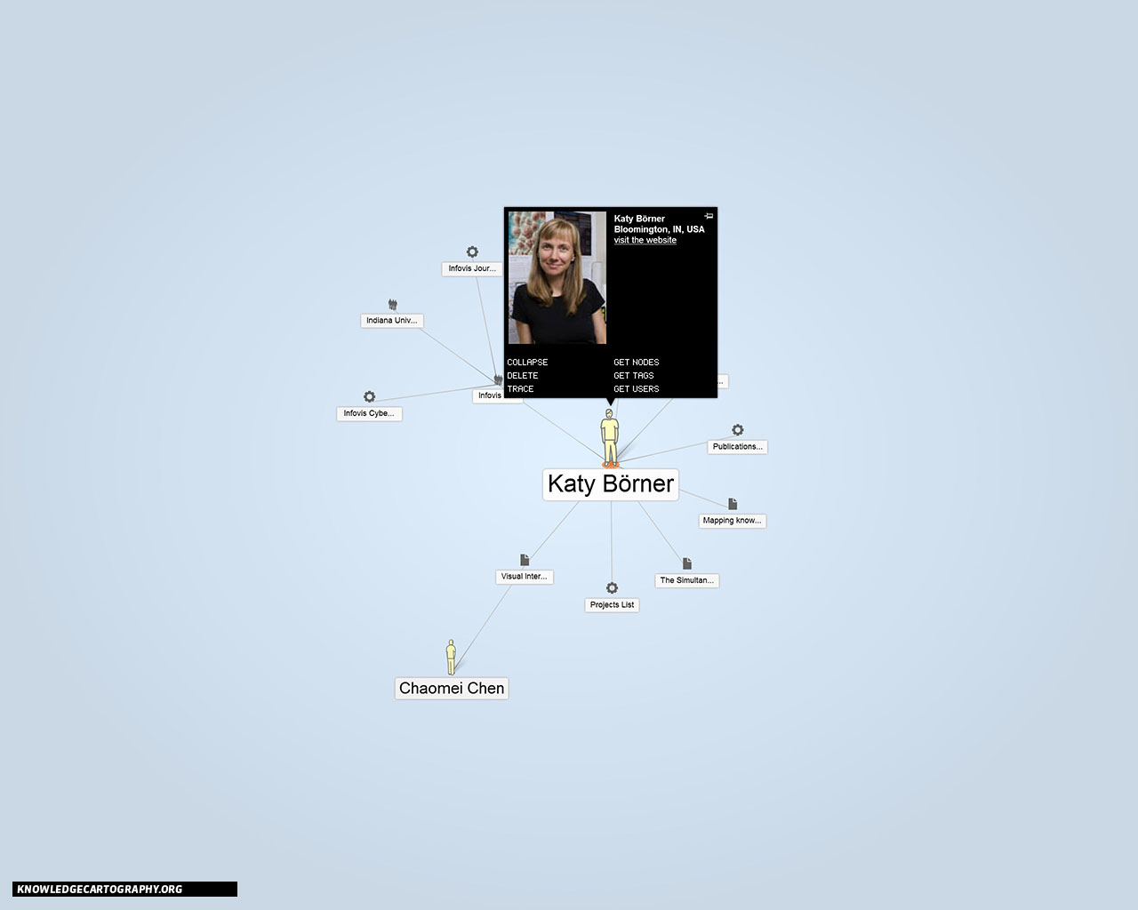
This website aims to present the results of the ongoing research on a
cartographic approach to the representation of knowledge in its present
configurations.
The aim of the research is to extend the cartographic metaphor beyond visual
analogy, and to expose it as a narrative model and tool to intervene in
complex, heterogeneous, dynamic realities, just like those of human
geography. The map, in this context, is not only a passive representation of
reality but a tool for the production of meaning. The map is thus a
*communication
device*: a mature representation artefact, aware of its own language and its
own rhetoric, equipped with it its own tools, languages, techniques and
supports. A model that recovers the narrative abilities of pre-scientific
maps and presents itself not as a mere mimetic artefact, but as a poetic and
political tool

*The map as narration* is thus the expression of a communicative purpose.
Just like a text, the map makes selections on reality, distorts events,
classifies and clarifies the world in order to selections better tell a
particular aspect of a territory, an event, a space. When used with malice,
it can hide, conceal, falsify or diminish a reality through the construction
of an ideological discourse, in which the communicative aims are hidden to
the user. In this context, the term ‘map’ is a synonym of visual narration
of space: a cultural artefact created by an author to describe a space
according to an objective.

*The map as a tool* appears instead as a means that enables the user to
reach an otherwise unattainable goal. It allows not only to do things
better, more efficiently, but also to create new realities. As an
instrument, the map expects a user using it to achieve an end, and similarly
a designer, who must ensure that the structure of the instrument is as
suited as possible for the achievement of the planned tasks.
IMAGES

The images displayed below are screenshots taken from ATLAS, the application
that's being developed to explore the possibilities of the application of a
cartographic metapjor to the realms of knowledge. The concept of *atlas* in
this context doesn’t depict as much a list of maps, but rather a system of
representations of space, a communication device aimed at representing
complex contexts through the use of many partial overlapping narrations: a
network of maps, diagrams, texts and peritexts, combined together to
describe the space of research in its multifaceted aspects.

If you need/want to use the images in any context, both in print and digital
media, please let us know.
 [image: knowledge map]
<http://knowledgecartography.org/BIG/02-14-03.jpg>   [image:
knowledge map] <http://knowledgecartography.org/BIG/10-34-49.jpg>  [image:
knowledge map] <http://knowledgecartography.org/BIG/07-01-50.jpg>   [image:
knowledge map] <http://knowledgecartography.org/BIG/10-51-09.jpg>  [image:
knowledge map] <http://knowledgecartography.org/BIG/07-39-18.jpg>   [image:
knowledge map] <http://knowledgecartography.org/BIG/09-28-51.jpg>  [image:
knowledge map] <http://knowledgecartography.org/BIG/11-12-24.jpg>   [image:
knowledge map] <http://knowledgecartography.org/BIG/11-47-30.jpg>

--
Arnaud VELTEN "Ce qui ne s'adapte pas est voué a disparaitre"
@BIZCOM FAX : +33 (0)957237327

--

Vous recevez ce message, car vous êtes abonné au groupe Google
Groupes Cartographie d'informations.
Pour envoyer un message à ce groupe, adressez un e-mail
à [email protected].
Pour vous désabonner de ce groupe, envoyez un e-mail à l'adresse
[email protected].
Pour plus d'options, consultez la page de ce groupe :
http://groups.google.com/group/carto-infos?hl=fr