secoworld opened a new issue #12551:
URL: https://github.com/apache/incubator-echarts/issues/12551
### What problem does this feature solve?
能够绘制气象探空数据,用作气象分析以及地球科学的可视化功能
### What does the proposed API look like?
数据类型是:
```json
"Station_Name": "xxx",
"Station_Id_C": "3344",
"Lat": "23.44",
"Lon": "123.44",
"Alti": "10.0",
"data": [
[
"1020",
"20",
"3.8",
"1.5",
"25",
"14"
],
[
"1000",
"222",
"2.8",
"0.6",
"25",
"19"
],
]
```
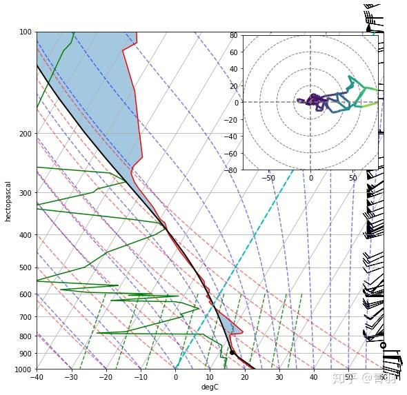
希望绘制出来的图形是这样的:
<!-- This issue is generated by echarts-issue-helper. DO NOT REMOVE -->
----------------------------------------------------------------
This is an automated message from the Apache Git Service.
To respond to the message, please log on to GitHub and use the
URL above to go to the specific comment.
For queries about this service, please contact Infrastructure at:
[email protected]
---------------------------------------------------------------------
To unsubscribe, e-mail: [email protected]
For additional commands, e-mail: [email protected]