Hi,

On Mon, Mar 5, 2012 at 12:14 PM, npl <[email protected]> wrote:
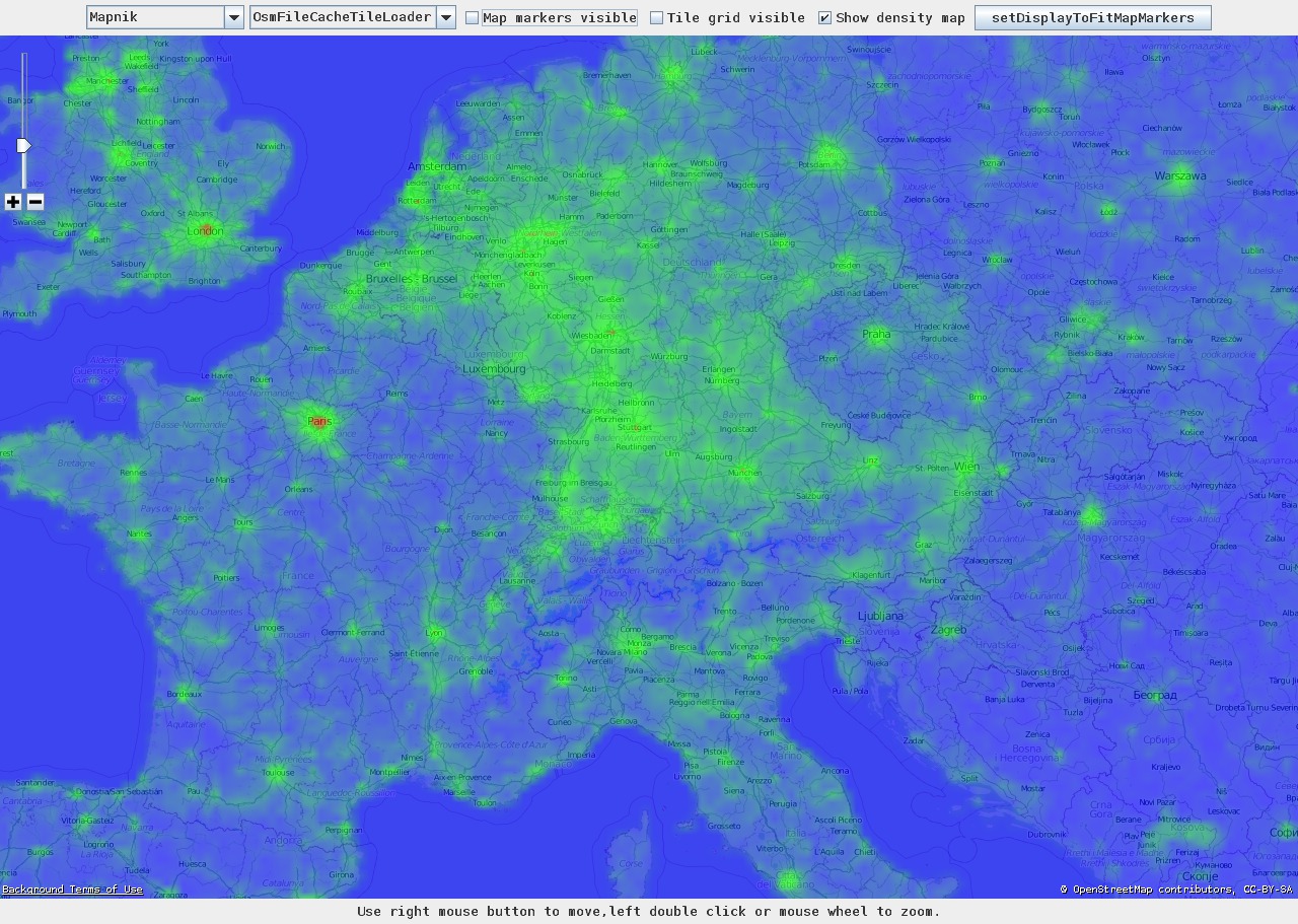
> Hi
>
> Last semester, a few other guys and I were involved in a project, where we
> wanted to get familiar with hadoop. Since OSM has "big data", we decided to
> do some hadoop processing on the osm planet-file. We ended up creating a
> StreetDensityMap of the world, and extended JMapViewer for the graphical
> output. (screenshot of europe: https://raw.github.com/npl/**
> dda/master/screenshots/osm_**density_europe.jpg<https://raw.github.com/npl/dda/master/screenshots/osm_density_europe.jpg>
> )
>
> The project is hosted at github: https://github.com/npl/dda
>
>
Cool. I've been wanting to give hadoop / map/reduce a try with OSM data but
the wiki does not offer much. It would be nice if someone with some
experience would create a wiki page. I'm sure it would be interesting for
the community as well as GIScience folks to have a place to start.


> It gives also a sort-of "osm activity map".
>

Well, it does and it doesn't. You'd have to compare it to a reference road
network density map to appreciate the activity of the OSM community in
representing reality in OSM.

I see a lot of potential for this beyond 'simple' visualisation. Systems
like TagInfo and OWL could benefit, maybe? Does your framework lend itself
for (near) real time processing of OSM data, or does it only work with
snapshot data?


> If you want to try it out, you will need your own hadoop cluster (well, a
> few nodes a few hours long is enough) -- there is no public server
> available. If you've any questions, don't hesitate to ask me!
>
> - npl
>
> ______________________________**_________________
> dev mailing list
> [email protected]
> http://lists.openstreetmap.**org/listinfo/dev<http://lists.openstreetmap.org/listinfo/dev>
>


--
martijn van exel
geospatial omnivore
1109 1st ave #2
salt lake city, ut 84103
801-550-5815
http://oegeo.wordpress.com
_______________________________________________
dev mailing list
[email protected]
http://lists.openstreetmap.org/listinfo/dev