> From: [EMAIL PROTECTED] On Behalf Of Druss the Mighty
> Sent: Thursday, December 14, 2000 15:38
>
> This is worth the time to download. I have it as my wallpaper. :)
>
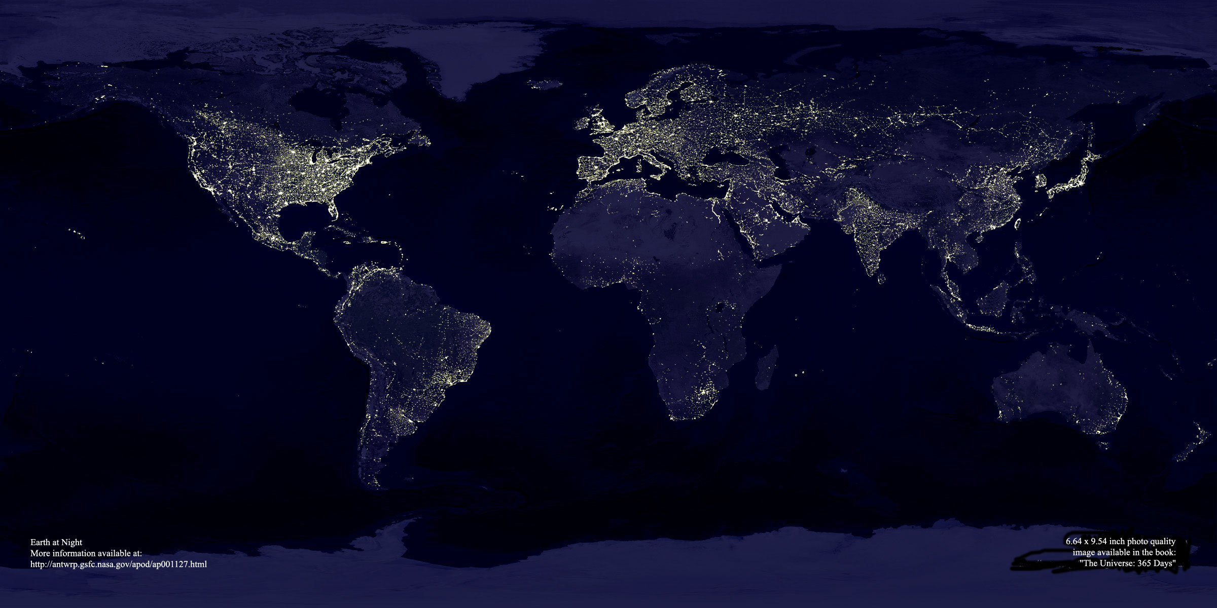
> http://antwrp.gsfc.nasa.gov/apod/image/0011/earthlights_dmsp_big.jpg
>
> Ron
Thanks for the link, Ron. It's a great image. Too bad there is so
much distortion as you move away from the equator. Greenland, for
example, appears almost as big as the United States but in reality
it is much smaller. And Antarctica is HUGE. That's what happens
though when you project a spherical surface into a cylinder and
then unroll it get a flat image. Like peeling an orange, the pieces
don't just lay flat and form a nice rectangle like this satellite
composite tries to do.
For a more accurate world map based on satellite images, check out
the links below. I sometimes use this as my desktop wallpaper.
I think the strikingly beautiful image is potentially world-mind
transforming in that it shows all of humanity living on one world
island rather than split up by East, West, North, and South.
A HUGE (1280x640) color version of the latest Fuller Projection
(cloudless satellite map of Earth):
http://www.csn.ul.ie/~caolan/publink/xplanet/fuller_1280x640.jpg
The Dymaxion Map is the only flat map of the entire surface of
the earth that reveals our planet as it really is: an island in
one ocean without any visible distortion of the relative shapes
and sizes of the land areas, and without splitting any continents.
Dymaxion map info and history:
http://www.bfi.org/map.htm
Animation of Earth globe transformed into a flat surface map:
http://www.bfi.org/map_animation.html
Dexter Graphic