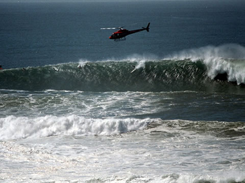
Ever wonder why the surf is so huge at place like Mavericks in Northern
California?
http://www.hellblazer.com/media/mavericks.jpg
http://www.surfersvillage.com/img/st/SMHbigsurfSCOTT2-pop.jpg
<http://www.surfersvillage.com/img/st/SMHbigsurfSCOTT2-pop.jpg>Here's
how and why:
http://www.mbnms-simon.org/other/moreLinks/whats_new_mavericks.php
" The California Ocean Protection Council and National Oceanic and
Atmospheric Administration (NOAA) National Marine Sanctuary Program
recently announced findings revealing unprecedented detailed imagery of
the seafloor, including in areas of the Monterey Bay National Marine
Sanctuary off Half Moon Bay, where the famed "Mavericks" waves are among
the largest in the Continental United States.
The California Coast State Waters Mapping Project
<http://www.coastalconservancy.ca.gov/Programs/SeaFloorMapping/SeafloorMapping.htm>
allows scientists for the first time to see highly detailed,
three-dimensional images of the seafloor off California's coast. New
data illustrates the rugged seafloor conditions surrounding Mavericks
more clearly and helps better explain ocean ecosystems and underwater
activities like large waves and earthquakes. "
<http://www.mbnms-simon.org/other/moreLinks/whats_new_mavericks.php>
_______________________________________________
Geowanking mailing list
[email protected]
http://lists.burri.to/mailman/listinfo/geowanking