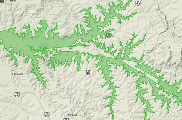
Well, I think I solved it with some help from Shaun H.
It was a bad data problem, the parsing of my input polygon had some
problems.
Its now working:
http://img.photobucket.com/albums/v348/The_Customan/working2.jpg
Cláudio
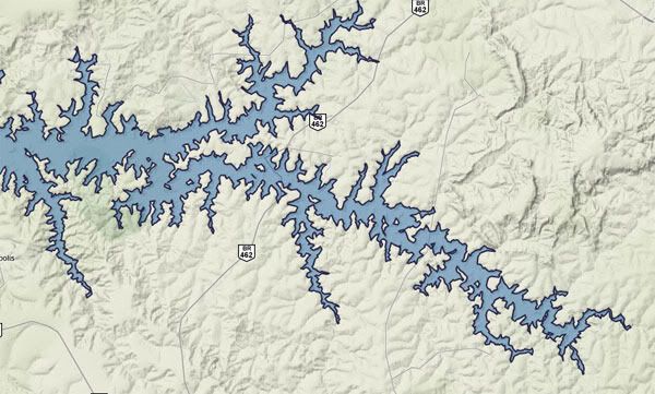
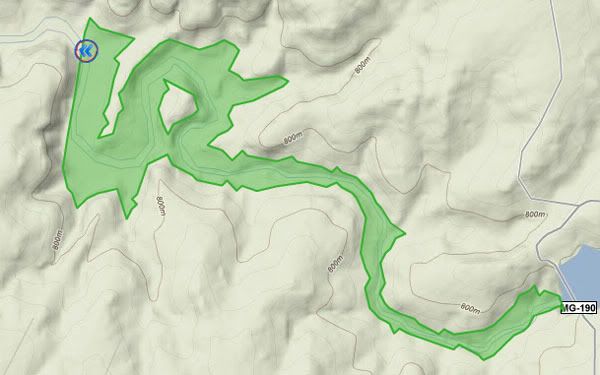
On 10 fev, 16:01, Cláudio <[email protected]> wrote:
> Hi, I'm developing a kind of "Flooding tool" using GoogleMaps+ Flex
> and I've been having some troubles. I've been using EncodedPolygons to
> display polygons with holes and it actually works fine for some cases.
> But sometimes I get some weird polygons and I don't know what may be
> causing it.
> For example:
> This polygon is ok
> -http://img.photobucket.com/albums/v348/The_Customan/working.jpg
> This one is not
> -http://img.photobucket.com/albums/v348/The_Customan/notWorking.jpg
>
> So, if anyone has a clue of what is the problem I'd be thankful.

--
You received this message because you are subscribed to the Google Groups
"Google Maps API For Flash" group.
To post to this group, send email to [email protected].
To unsubscribe from this group, send email to
[email protected].
For more options, visit this group at
http://groups.google.com/group/google-maps-api-for-flash?hl=en.