Jim,

please post your GRASS version to the list to better help.
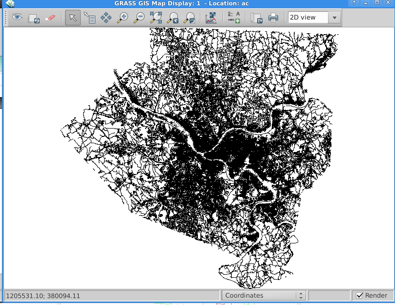
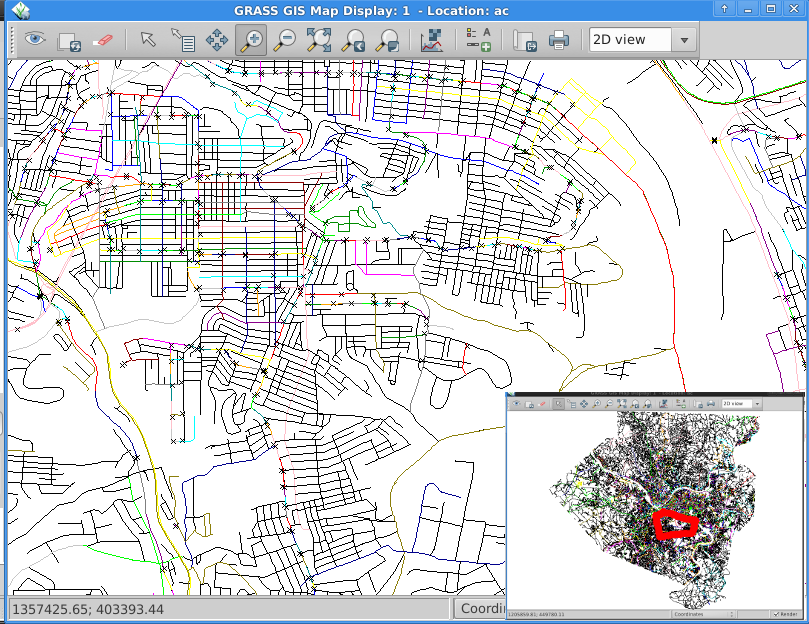
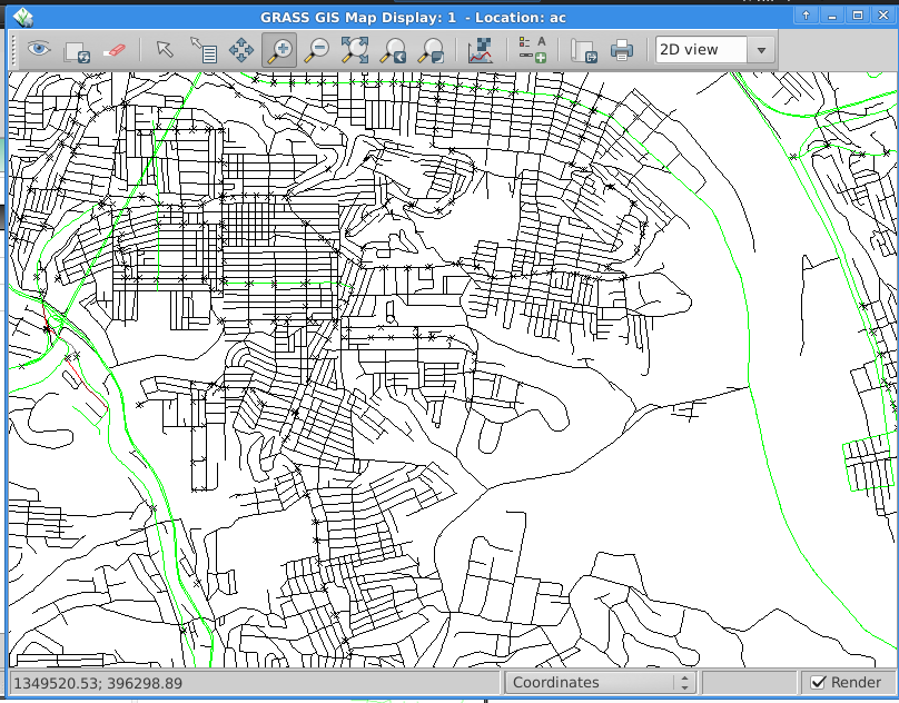
Markus

On Thu, Aug 28, 2014 at 1:40 PM, James Keener <[email protected]> wrote:
> I'm trying to create a map with isolines for the road-distance places
> are from bus routes.  I was trying to roughly follow
> http://jcastellssala.wordpress.com/2012/05/07/basic-network-analysis-with-grass/
> but I don't quite get similar results (I feel like the network isn't
> completely connected, but this is the first time I'm doing this so it's
> more likely I'm just doing it wrong.
>
> I am using the following shapefiles in SRID 2272 (NAD83 / Pennsylvania
> South (ftUS)):
>
> http://jimkeener.com/grass-topo-question/roads.tar.bz2 which is the
> TIGER road graph for Allegheny County, PA, USA (state fips = 42, county
> fips = 003), but reprojected to 2272 and a "length" attribute added.
>
> http://jimkeener.com/grass-topo-question/stops.tar.bz2 which is derived
> from the Port Authority of Allegheny County GTFS file found at
> http://www.portauthority.org/paac/CompanyInfoProjects/DeveloperResources.aspx
> and reprojected to 2272.
>
>
> So, the first thing I did is import these files:
>
>> v.in.ogr dsn=roads.shp layer=roads output=roads
>> v.in.ogr dsn=stops.shp layer=stops output=stops
>
> (http://jimkeener.com/grass-topo-question/ac.png)
>
> Then I connect the stops to the network
>
>> v.net input=roads points=stops output=network operation=connect thresh=500
>
> Connect the require database layer
>
>> v.db.connect map=network table=schools layer=2
>
> Then allocate the network
>
>> v.net.alloc --overwrite --verbose input=network output=network_alloc
>> ccats=1-6965
>
> (http://jimkeener.com/grass-topo-question/ac-alloc-zoom-thumb.png when
> displayed with d.vect -c) (the little Xs are bus stops
>
> And create isolines at 1-, 2-, and 3- thousand feet
>
>> v.net.iso --overwrite input=network output=network_isolines ccats=1-6965
>> costs=1000,2000,3000 afcolumn=LENGTH abcolumn=LENGTH
>
> (http://jimkeener.com/grass-topo-question/ac-isolines-zoom.png also with
> d.vect -c)
>
> All but a few of the roadways near the open space to the right (a park
> and very hilly (even by Pittsburgh standards:-p) area) are within 3000
> feet of a bus stop.  Therefor I was expecting almost all of the roads to
> be highlighted in different colors representing their distance from a stop.
>
> Thank you for any help!
> Jim
>
>
> _______________________________________________
> grass-user mailing list
> [email protected]
> http://lists.osgeo.org/mailman/listinfo/grass-user
_______________________________________________
grass-user mailing list
[email protected]
http://lists.osgeo.org/mailman/listinfo/grass-user