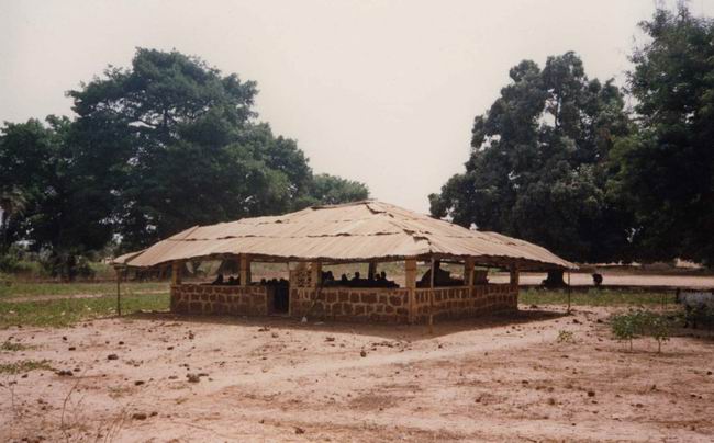
You seem to refer to this oval form object at the center. You see shadow, and
I would also interpret this as a building (building=yes).
We cannot tell if this is building=roof for example. Architecture is related to
climate. In Guinea, the structures can be simply a roof or houses. See a "case
à palabre" (translation: the hut of palaver ) where the elders of the village
discuss http://www.guinee-bissau.net/photos/casemanjak.jpg
 See also various examples
https://www.google.ca/search?q=habitat+traditionnel+guinee&tbm=isch&tbo=u&source=univ&sa=X&ei=S22PVKOWA5LGsQSz7YGYAw&ved=0CC8Q7Ak&biw=1252&bih=539

In this same village, going west we see a mix of huts and houses. We cannot
tell if these huts are only roofs to protect from the sun as we se on this
image http://mediatheque.francophonie.org/Village-guineen-Baie-de-Sangareya.html
Then for the huts, we add the tag building=hut
I will ask if field teams can provide us some pictures of this village.

Pierre

      De : althio forum <[email protected]>
 À : HOT Openstreetmap <[email protected]>
 Envoyé le : Lundi 15 décembre 2014 17h04
 Objet : [HOT] [Feature Interpretation] #817 - Guinea, Kankan East

Hi all

Is this something specific to tag or just any building?

https://www.openstreetmap.org/#map=20/10.407096/-9.21729

_______________________________________________
HOT mailing list
[email protected]
https://lists.openstreetmap.org/listinfo/hot
_______________________________________________
HOT mailing list
[email protected]
https://lists.openstreetmap.org/listinfo/hot