After my last email, I'm back to present the data that I have to import.  I'm
working through this and will update the Wiki progressively.
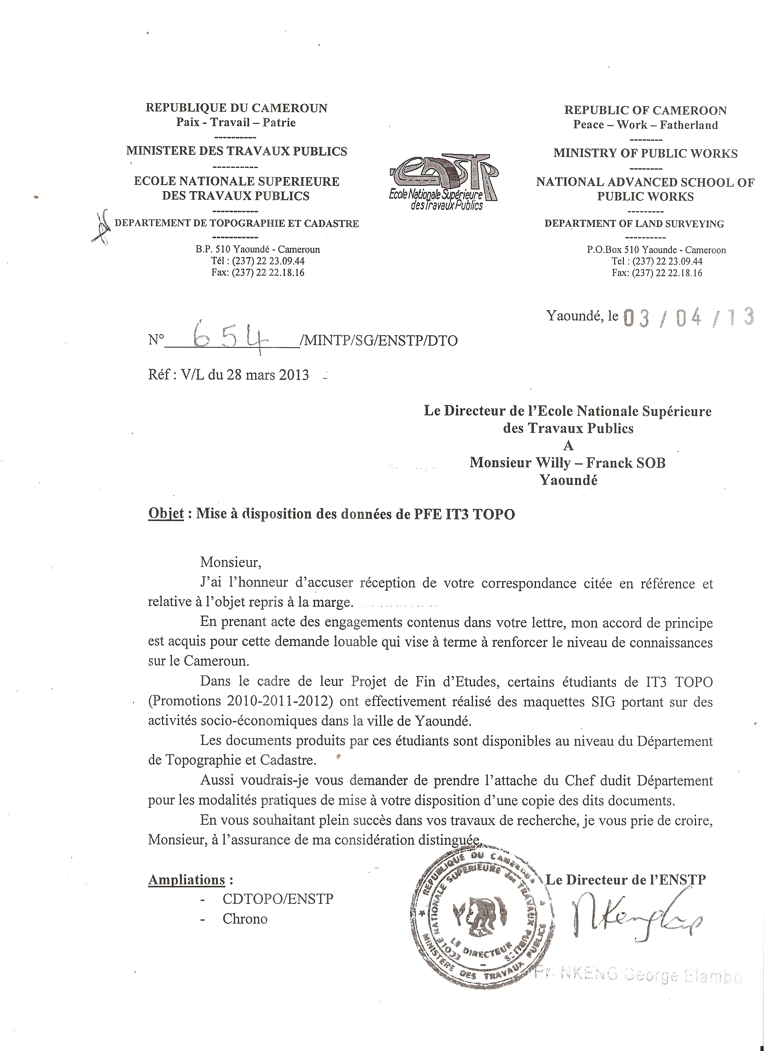
1.) The files to process are divided into three categories :

*occupation_du_sol.shp(landuse):*

*FORET:* landuse = forest

*FRICHE*: natural = scrub

*CULTURE:* landuse = farmland

*hydrographie.shp (hydrography):***

*MARECAGE:* natural = wetland ; seasonal = yes ; tidal = yes

*RUISSEAU:* waterway = stream ;

*BASSIN:* natural = water

*routes.shp (roads):***

*ROUTE PRINCIPALE:* highway = primary

*ROUTE SECONDAIRE:* highway = secondary

*ROUTE PISTE:* highway = residential

*CHEMINS:* highway = path

*Nbrs_Voies:*  lanes = value

*Sens_Circ:* onway= yes/no

*REVETEMENT:* surface = paved/ unpaved

*LARGEUR:* width = value

*ETAT:*  smoothness = good/ intermediate

2.) The files are translated by Ogr2OSM.

I use the tag (source = "survey:PFE(IT3) ENSTP Yaounde 2010") to
comply with the
request that I made to the headmaster of the Survey School of Yaoundé.

I have acquired some POIs by video surveying. In this case I put the (
source= GeoCameroun) to distinguish my data from those of the students.

However, a special account has been created for these imports. (
http://www.openstreetmap.org/user/GeoCameroun)

  3.)  Accuracy

These data were acquired over three years by the students through surveying
in the Cameroon datum. During my recent trip to Yaoundé, I've verified with
the local community the semantic accuracy of these data.

  4.) License

I received the data for my dissertation study and conditions of use are
compatible with the OSM license. (
http://wiki.openstreetmap.org/w/images/f/f1/Autorisation_ENSTP.jpg)

Do not hesitate to contact me for any information about the project

 Sincerely,
_______________________________________________
Imports mailing list
[email protected]
http://lists.openstreetmap.org/listinfo/imports