Hello guys !

I currently have some problems in the quality of the images produced by
GDAL/Mapserver.
We are using MapServer to serve raster imagery to NASA Worldwind.
Our files are in UTM and Worldwind needs WGS84 images so we do reprojection on
the fly.
Using this, we can clearly see image quality artefacts between Worldwind (using
WGS84, no choice) and a custom internal tool (showing original data).
I can reproduce the problem using gdalwarp tool using a very simple command
line :
gdalwarp -multi -t_srs EPSG:4326 -srcnodata 0 -dstnodata 0 -r near
%FileSrc%/*_p_*8bit.tif %FileDest%
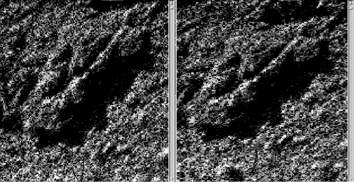
You can see the result on
http://benoit.andrieu.free.fr/mapserver/Clipboard02.png : on the right, the
original image and on the left, the resulting output.
I suspect that using some others settings, I could improve the quality on
gdalwarp's output in a first time and on mapserver's output in a second time
but I don't know where to start...
So if anyone could help or suggest anything, he will be welcome !!!
Thanks in advance,
Benoît
_______________________________________________
mapserver-users mailing list
mapserver-users@lists.osgeo.org
http://lists.osgeo.org/mailman/listinfo/mapserver-users