Hi,

As a many year gis user, but fairly new to internet mapping applications, I am
getting my feet wet by experimenting a bit with mapserver.
As I am doing a lot of mapping of marine areas, I want to use the etopo dataset
as a backdrop, but something goes terribly wrong when I try to project it. In
my mapfile, I have defined the extent and projetion as:
EXTENT -800000 -1500000 850000 1300000 #LAEA
UNITS METERS
PROJECTION
"proj=laea" #
"lat_0=70"
"lon_0=15"
END
And the etopo dataset is fetched as:
LAYER
PROJECTION
"init=epsg:4326"
END
NAME Etopo2
TYPE RASTER
OFFSITE 0 0 0
STATUS ON
CONNECTIONTYPE WMS
CONNECTION
"http://map.ngdc.noaa.gov/servlet/com.esri.wms.Esrimap?servicename=Deck41";
METADATA
"wms_srs" "EPSG:4326"
"wms_name" "MODIS/ETOPO2 Relief"
"wms_server_version" "1.1.0"
"wms_format" "image/jpeg"
END
END # Etopo2 WMS image ends here
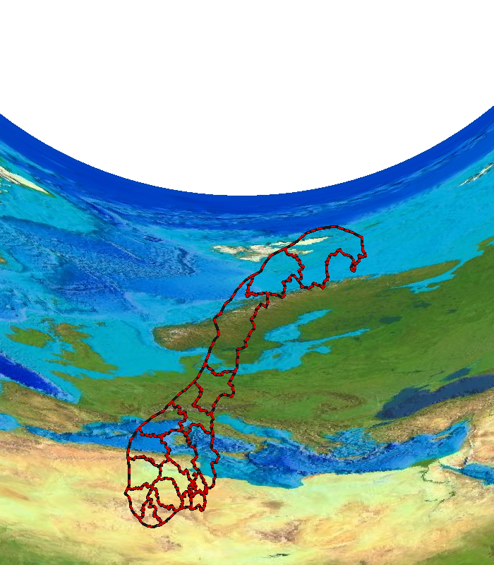
What I end up with then can be seen in
http://radioecology.info/images/etopo_laea.png
(the red lines are administrative borders in Norway) if I make the same map
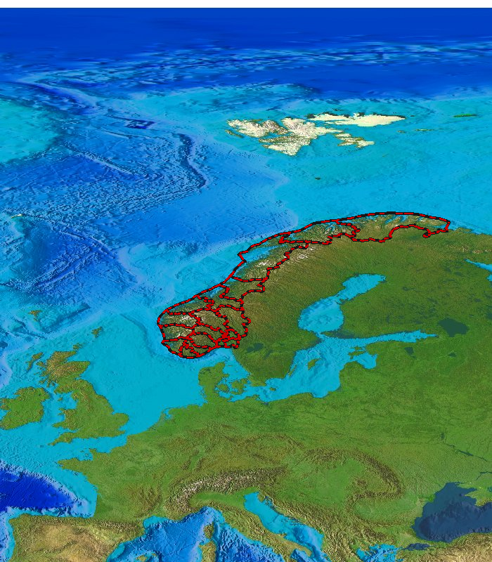
without projection, it ends up like
http://radioecology.info/images/etopo_geo.png (the borders are supposed to
extend a bit out into the sea)
If I try to ue the topographical gtopo map, I fetch it with
etop
LAYER
NAME GTOPO
TYPE RASTER
OFFSITE 0 0 0
STATUS OFF
CONNECTIONTYPE WMS
CONNECTION
"http://imsref.cr.usgs.gov:80/wmsconnector/com.esri.wms.Esrimap/USGS_EDC_Elev_GTOPO?";
METADATA
"wms_srs" "EPSG:4326"
"wms_name" "GLOBAL.GTOPO60_COLOR_RELIEF"
"wms_server_version" "1.1.1"
"wms_format" "image/jpeg"
END
PROJECTION
"init=epsg:4326"
END
END
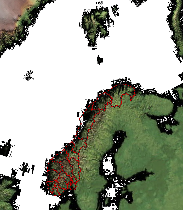
And I get http://radioecology.info/images/gtopo_laea.png which looks just
right.
Any Idea of what goes wrong? The etopo dataset obiously gets projected, but I
have no idea about how, I have also tried a few other projections, getting the
same result, etopo freaking out, gtopo working nicely... Have anyone had any
success in reprojecting etopo? Are there any other wms sources I can use? (Of
cource, I can download the tiles I need and reproject and mess around with them
as I like to, but it would also be useful to be able to use the etopo wms
server.
Morten
--
Morten Sickel
Norwegian Radiation Protection Authority
_______________________________________________
mapserver-users mailing list
[email protected]
http://lists.osgeo.org/mailman/listinfo/mapserver-users