Hi Jeff,

I am an amateur radio operator, and I am writing a little application to
display where the major lobe of my antenna is pointing.  I can control the
direction of my antenna with the computer, and it would be nice to have a
display of the whole world, as well as circles representing how far the
station I am talking to is, and radial lines showing the bearings.  I'd like
to show the bearings along the edge of the map.  For this type of map, a
circle is a much better boundary than a square, but if it has to be a
square, we should be able to make it a square bounding the circle, not the
other way around.  I think I can even plot the station's location given data
I get from the Internet using this software.  I am just learning Python, but
it appears to be ideal for what I'm doing.
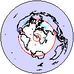
Right now I'm trying to figure out how to get the Eclipse IDE I am trying
out to show me the source code for Basemap.  :-)

Thanks for the expert help!

Rob

Jeff Whitaker wrote:
>
> Rob Frohne wrote:
>> Hi,
>>
>> I think I am running into the same thing John is here.  When you want to
>> display the whole earth in 'aeqd' mode, the projection needs to be onto a
>> circle.  As it is, what is plotted is a square that just fits inside the
>> circle I want.  Here is a link to a photo of the kind of projection I
>> want.
>>
>> http://www.wm7d.net/az_proj/images/lon_anim_shaded.gif
>>
>> Is there a way to get the whole earth plotted with 'aeqd'?
>>
>
> Rob:  No, you can't get the whole earth - the most you can get is the
> cube that fits within it.  I can look into adding that functionality for
> the aeqd projection if there's a real use case.  Note that there are
> other whole-earth projections available (mollweide, vandergrinten,
> robinson, sinuisoidal etc).  These projections have much less distortion
> far away from the center of the map than the azimuthal equidistant
> does.  Why do you want to use aeqd to plot the whole globe?
>
> -Jeff
>> Thanks,
>>
>> Rob
>>
>
>
>>
>> John [H2O] wrote:
>>
>>> Hello,
>>>
>>> I'm creating a web application that will take user input from a
>>> javascript
>>> map to give me bounding coordinates (i.e. urcrnrlat, urcrnrlon,
>>> llcrnrlat,
>>> llcrnrlon) and possibly a switch for polar projection. Other than that I
>>> have no further information. Which projection is the most suitable to
>>> handle anything from a 'global' plot to a zoom say over a state? I don't
>>> see the zoom being too tight, but global projections are likely. I
>>> personally prefer Equal Area, hence right now I'm working with 'aeqd',
>>> but
>>> I seem to have problems if the plot is global with that projection.
>>>
>>> Just looking for advice, opinions, and ideally examples if anyone has
>>> created a similar function / module to use in a web environment.
>>>
>>> Thanks!
>>> -john
>>>
>>>
>>
>>
>
>
> --
> Jeffrey S. Whitaker         Phone  : (303)497-6313
> Meteorologist               FAX    : (303)497-6449
> NOAA/OAR/PSD  R/PSD1        Email  : [email protected]
> 325 Broadway                Office : Skaggs Research Cntr 1D-113
> Boulder, CO, USA 80303-3328 Web    : http://tinyurl.com/5telg
>
>
> ------------------------------------------------------------------------------
> _______________________________________________
> Matplotlib-users mailing list
> [email protected]
> https://lists.sourceforge.net/lists/listinfo/matplotlib-users
>
>

--
View this message in context:
http://www.nabble.com/dynamic-basemap-tp20121594p21225725.html
Sent from the matplotlib - users mailing list archive at Nabble.com.


------------------------------------------------------------------------------
_______________________________________________
Matplotlib-users mailing list
[email protected]
https://lists.sourceforge.net/lists/listinfo/matplotlib-users