Hi all,
I am working on a tool that will calculate the travel time from villages
to for instance the nearest hospital for rural accessibility analysis.
So far I have build a tool which will calculate this for 215.000
villages in a few minutes, thanks to the help of Daniel P. However I
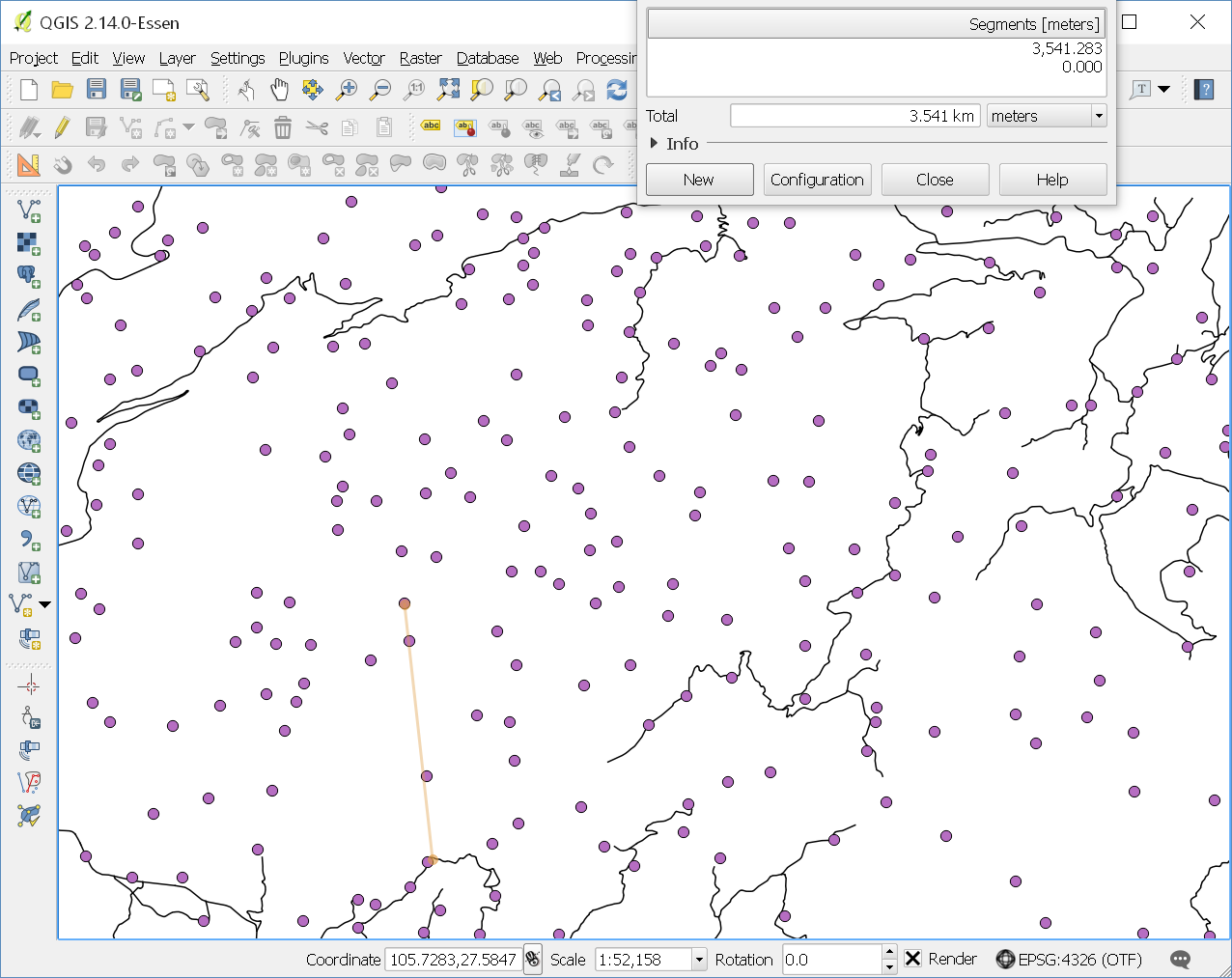
realized that not all villages are on a road, actually quite a few are
at least an hour walk from the nearest drivable road see:
http://stvno.github.io/img/OSRM-snapping.png
The villages are typically connected to the roads by informal trails,
which I do not have as a road network. So I was wondering if it would be
possible to add a basic penalty to the distance of the point to the
nearest road.
I am aware that the nearest service will provide me with the distance:
https://github.com/Project-OSRM/osrm-backend/wiki/New-Server-api#service-nearest
but before I am going to calculate the extra traveltime for each
village, I was wondering if it is possible to integrate this with an
osrm.table request. I am aware this opens quite a can of worms: if there
is a penalty to snapping, it might be worth it to snap to a road which
is further away, but in the end quicker to get to the destination. But
for the moment I'm happy with just the added traveltime for nearest road
snapping.
Any suggestions on how to handle this?

Steven


_______________________________________________
OSRM-talk mailing list
[email protected]
https://lists.openstreetmap.org/listinfo/osrm-talk