No, that would be a very hard computer vision problem because of the
styles and overlays. You will be faster and more accurate if you
recreate an approximation of the hexagonal grid and then retrace all
polygons manually using those cells.
Am 25.10.23 um 13:37 schrieb krishna Ayyala via QGIS-User:
I am reposting this question.Can anyone please help?
Hello,
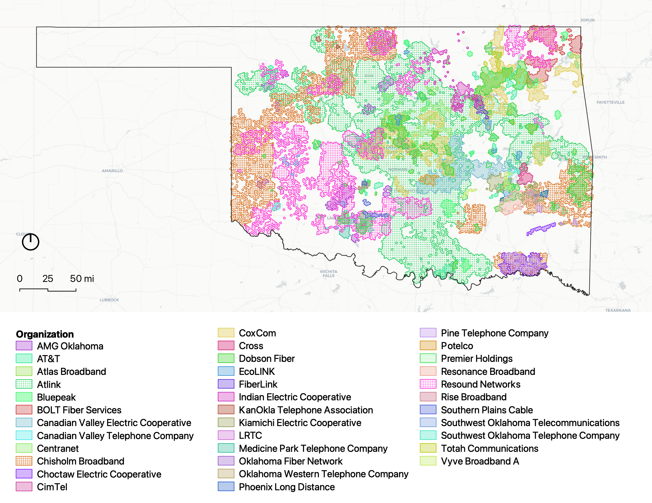
I have a png file. This has polygons with 36 categories as shown in
the legend. Is it possible to convert this file to a vector file such
as .shp or gpkg file? When I open the attribute table, it should be
able to distinguish between each of these 36 categories. Below is the
weblink to png. Can anyone help me with this please?
Regards.
ListofProjects.png (2200×1700) (oklahoma.gov)
<https://oklahoma.gov/content/dam/ok/en/broadband/documents/grant-programs/arpa-slfrf-ii/ListofProjects.png>
_______________________________________________
QGIS-User mailing list
QGIS-User@lists.osgeo.org
List info:https://lists.osgeo.org/mailman/listinfo/qgis-user
Unsubscribe:https://lists.osgeo.org/mailman/listinfo/qgis-user
--
Johannes Kröger / GIS-Entwickler/-Berater

---------------------------------------------
Aufwind durch Wissen!
Web-Seminare und Online-Schulungen
bei derwww.foss-academy.com
---------------------------------------------

WhereGroup GmbH
c/o KK03 GmbH
Lange Reihe 29
20099 Hamburg
Germany

Tel: +49 (0)228 / 90 90 38 - 36
Fax: +49 (0)228 / 90 90 38 - 11

johannes.kroe...@wheregroup.com
www.wheregroup.com
Geschäftsführer:
Olaf Knopp, Peter Stamm
Amtsgericht Bonn, HRB 9885
-------------------------------
_______________________________________________
QGIS-User mailing list
QGIS-User@lists.osgeo.org
List info: https://lists.osgeo.org/mailman/listinfo/qgis-user
Unsubscribe: https://lists.osgeo.org/mailman/listinfo/qgis-user