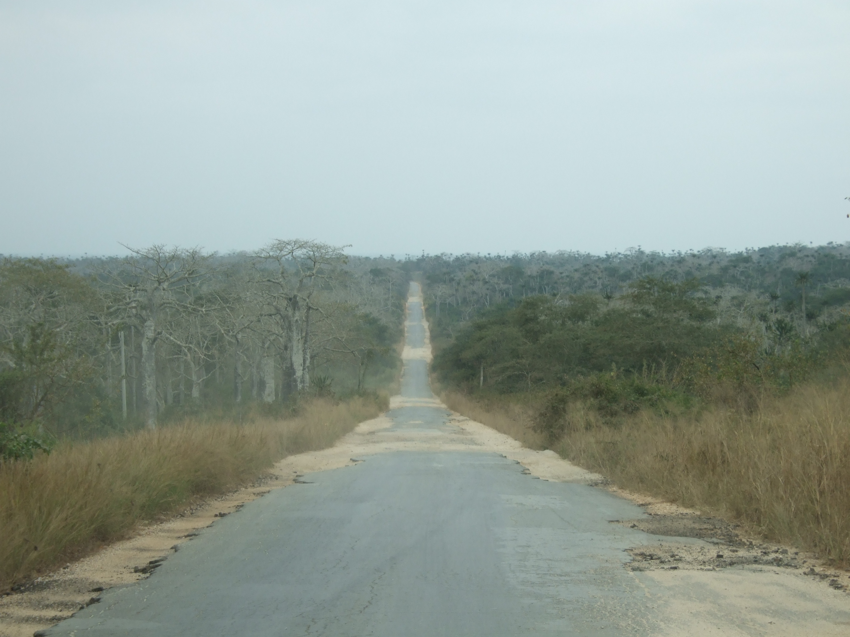
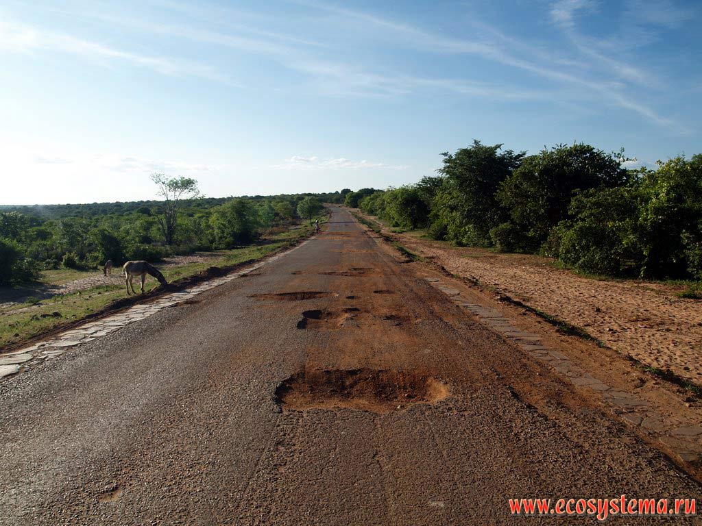
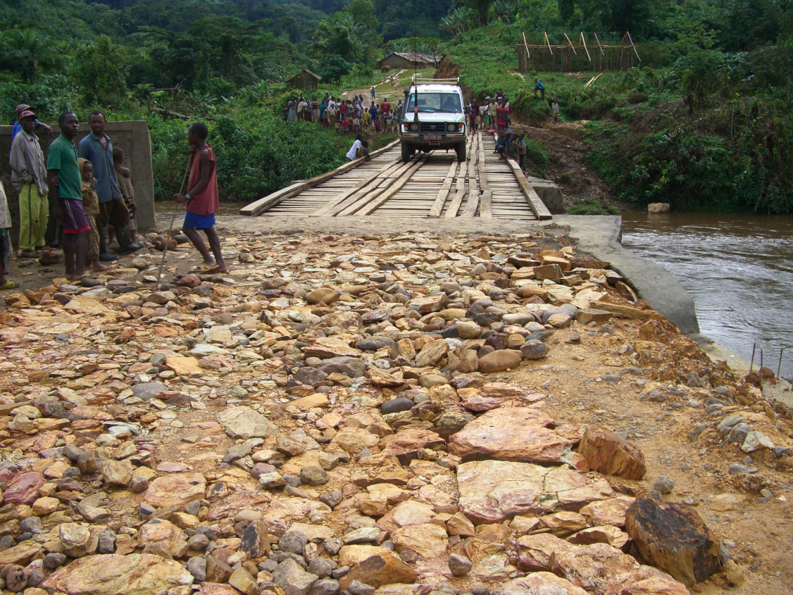
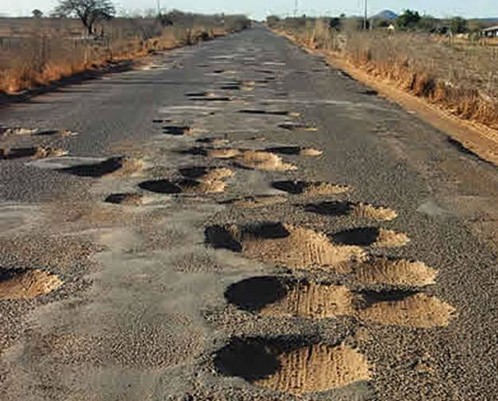
Why 40, or why 50? Are these sensible choices for ways like those below?
*
http://cdn.c.photoshelter.com/img-get/I0000LEZumn6Zhqo/s/900/900/ERITREA-00085-BC3.jpg
* http://www.mongolia-travel-guide.com/image-files/mrm-mongolia-main-road.jpg
* http://www.horizonsunlimited.com/tstories/duval/images/037%20IMG_3494.jpg
* http://farm3.staticflickr.com/2434/3897036578_12207239a3_o.jpg
* http://i37.tinypic.com/r74ro0.jpg
* http://www.ecosystema.ru/08nature/world/64ang/01.jpg
*
http://www.orderofmalta.int/wp-content/uploads/2011/07/Congo-new-road-MI-small.jpg
* http://beta.images.theglobeandmail.com/archive/00539/Road-1_jpg_539581gm-b.jpg
* http://codigolivre.net/wp-content/uploads/buracos-estrada.jpg
Take a look at the descriptions of tracktype, smoothness and surface
tag on the wiki, think about what their worst values are talking about
and about how widely each value of the surface tag can vary in meaning
for applications. Some people wouldn't even dare to try traveling
these roads. I doubt those that would, would do so at 40kmph on a
standard car, much less on a bike (which I don't think would capture
these situations).

You may wish to consider people's opinions on this thread too:
https://lists.openstreetmap.org/pipermail/tagging/2014-March/016977.html

On Fri, Mar 21, 2014 at 3:29 PM, Paul Johnson <[email protected]> wrote:
> On Fri, Mar 21, 2014 at 11:24 AM, André Pirard <[email protected]>
> wrote:
>
>> The problem comes with such roads as Belgian N674 which is uniformly
>> classified as national on IGN official maps. On the eastern part, it's worth
>> the primary status for through, heavy traffic.  On the center part, it's
>> certainly only secondary.  But on the part going NW it's a dangerous road.
>> And, despite its official status, only its 5 m width and bends can show that
>> : 2.5 m wide lorries can't cross each other and they step on the verge. The
>> road once crumbled down into the meadow below and is waiting for the next
>> turn. Even cars must break and make a brisk turn.  It would be nice that
>> OSM routing avoided that road.
>
>
> Sounds like a reasonably well equipped routing engine would naturally avoid
> it if there's a better alternate available just based on the number and
> radius of curves, classification of the roadway, surface type, and the
> vehicle being driven.  Bonus if horizontal and vertical limitations of the
> roadway are mapped and the routing engine is aware of the x, y and z
> dimensions of the vehicle in question (which is why I see a lot of
> "driverless vehicle" technology being more practical for navigation
> assistance for human drivers than as a fully autonomous vehicle).
>>
>> Of course everybody is free to add a road width as well, there is the tag
>> "width" for this, and also the tag "lanes". Unfortunately until now, only 5%
>> of all highway-elements (admittedly not only roads) have the tag lanes and
>> 1% has the tag width.
>>
>> The width would come as a complementary information: avoid it despite a
>> gentle official classification apparency.
>
>
> Does anyplace outside North America subjectively tag highway=* or is it
> formally tied to the official classification in most places, such as it is
> in the UK?
>>>
>>>   Moreover, the width can be very easily measured with JOSM on Bing.
>>
>>
>> you should be careful with the spherical mercator projection though, you
>> might end up with different widths for the same width due to different
>> latitudes, I am not sure how precise those measurements in JOSM actually are
>> (some time ago they weren't but maybe this is fixed now).
>>
>> Good point that would have to be analyzed. Especially if there's a
>> difference between NS and EW measurements!
>
>
> I would also be interested in hearing if the JOSM measurement tools are
> currently maintained to be accurate.  Granted, I'm not expecting it to be as
> accurate as finding some survey marks on either verge and start running
> survey lines (for a couple reasons, 1) A digital theodolite, it's
> accessories, getting licensed as a traffic control engineer, filing permits
> and putting out traffic control devices to do so safely and accurately is
> probably beyond the reach of almost everyone here besides the parallel
> universe me that won the Powerball jackpot and now has nothing better to do;
> and 2) most available aerial imagery, when properly aligned, seems to be
> getting us a horizontal dilution of precision within the resolution of the
> imagery or better on objects created by relatively skilled and experienced
> mappers (based on triangulation from known survey markers to known points
> and lines when I've had the access to professional surveying equipment).
>>>
>>> Of course, the closely related parameter is speed.
>>
>>
>> related to width? I do not think there is a close relation, at least not a
>> reliable one.
>>
>> Speed (to drive safely) is not intrinsic but in fact a consequence of
>> other factors, including narrow width. Or it can be enforced.
>
>
> In some places, quite strictly.  Oklahoma will write you up for 76 in a 75
> maxspeed or 39 in a 40 minspeed.  The resulting speed uniformity does make
> Oklahoma one of the easier states to drive in, assuming your driving
> personality is more positive than chaotic neutral on either or both axes
> (otherwise, it tends to be expensive, dangerous or both).
>>>
>>> While reading your texts, I've had a crazy idea:  measuring vibration in
>>> the car. There are Android vibration measuring programs like Vibration
>>> Monitoring.  Alas, car vibration is very much dependent on car suspension.
>>> But would some of us experiment this or another idea and come up with a
>>> solution?
>>
>>
>> this sounds interesting indeed, while I agree that it mostly depends on
>> the car suspension. With (unsuspended) bicycles this would be more reliable
>> I guess, but still the ability of the driver / rider to avoid holes in the
>> surface might make a huge difference (e.g. in Rome there are some very bad
>> roads with profund holes that get tapped every now and then but later reopen
>> due to the heavy traffic. If you are on roads that you drive often you
>> almost automatically get the habit of avoiding them, also at higher speeds,
>> because you know their exact locations by mind).
>>
>> Yes, dodging the suspension would be the idea, see next.
>
>
> Even on a fixed-fork hardtail bicycle, ride quality is still drastically
> affected by tire pressure, diameter, width, and tread pattern, as well as
> the length of frame and load balance.  For the sake of finding the most
> middle-of-the-road measurements, I propose our "perfectly average vehicle"
> would be a 1950 Flying Pigeon PA-02 (this is still the current model year
> for this model, still being built) with a statistically average height and
> weight human driver, with the stock tires at the recommended pressure
> (assuming it has pneumatic tires; can't remember if it does or not).  I
> picked this because if you took every single vehicle on the planet and
> randomly picked one, your odds are nearly 1 in 2 that it will be a 1950
> Flying Pigeon PA-02.
>
>>
>> On 2014-03-20 21:15, Fernando Trebien wrote :
>>
>> Even so, we would still have to presume things about the driver's
>> personality (an adventurous person would not care much about rougher
>> surfaces, while a precaucious one would probably rather avoid them).
>> We can pick a "standard" personality (we don't even know that very
>> well without some statistics, do we?) or we can probe other people and
>> then apply statistics on the results.
>>
>> There would of course be a protocol such as driving at a 40 km/h constant
>> speed and in straight line, unless, of course, it would break something, a
>> fact that should of course intervene in the classification.
>
>
> For the sake of automation, 45 or 50 km/h might be a better speed choice, as
> most North America market vehicles lock out cruise control at speeds less
> than 25 or 30 MPH (which is lame, since I would like to lock in at 10 or 15
> MPH for parking lot and living street situations, freeing my foot to be
> waiting shy of the brake pedal).
>
>
> _______________________________________________
> Tagging mailing list
> [email protected]
> https://lists.openstreetmap.org/listinfo/tagging
>


--
Fernando Trebien
+55 (51) 9962-5409

"The speed of computer chips doubles every 18 months." (Moore's law)
"The speed of software halves every 18 months." (Gates' law)

_______________________________________________
Tagging mailing list
[email protected]
https://lists.openstreetmap.org/listinfo/tagging