Richard and Sam beat me to the response, but here's my understanding anyways:
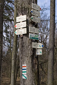
You can't copyright fact. The fact that a trail has some name is not
copyright-able. Collections of facts are copyright-able, however.

Let's say you come across a single trail marker such as that in
[http://www.travelpod.com/travel-photo/tombuttle/9/1228407840/10_trail_marker.jpg/tpod.html],
or a set of individual trail markers, like in
[http://blog.myczechrepublic.com/images/trebon-trail-markers.jpg].
These are stating facts (and could be considered different objects,
even when they are nailed to a single tree), and therefore are not
copyright (at least not in the Canadian/US system). In order to
collect the name of a trail, you would need to visit the trail head to
read the marker sign.

Now let's say you come across a trail map board, such as
[http://outdoors.webshots.com/photo/1120051478042125381wBnHBr]. This
would be considered a collection of facts, and is therefore protected
under copyright. You don't need to visit a trail head because somebody
has already collected the facts for you and assembled them into one
place.

Adam

On Sun, Feb 27, 2011 at 12:02 PM, Chris Bruce
<[email protected]> wrote:
> Bump!
>
> Anyone able to give me some guidance on this?
>
> Many thanks.
>
> ---
>
> On 11/02/2011 12:36, Chris Bruce wrote:
>>
>> Hi there,
>>
>> I've been doing a bit of mapping for the project in the UK, adding some
>> roads and trails generally from my area of mid-Wales. We have a bit of a
>> copyright problem with "naming" features in the UK that we have actually
>> surveyed. You can see the question and the responses on this link:
>> http://help.openstreetmap.org/questions/1286/determining-the-identity-of-features.
>> The government is being a bit more open and has released some data but there
>> seems to be some discussion about a possible conflict between its licence
>> and the OSM licence.
>>
>> I'm in Canada for a while and thought I'd map some trails while I'm here
>> per your WikiProject Canada page. I'm hiking in Provincial Parks and
>> National Parks in BC at the moment. I guess there will also be Regional
>> Parks. At the trailhead there are generally maps naming the trails and
>> features. Having hiked and tracklogged the trail am I permitted to "name"
>> the trail or feature in OSM from the information found at the trailheads?
>> (Or do I ask somebody who looks at the sign at the trailhead and then tells
>> me?!!!?)
>>
>> Also I'm aware that NRCan has released a huge amount of data for use. Can
>> I similarly "name" and draw features from information obtained from those
>> sources, e.g. the Topo tiffs?
>>
>> The reason I ask here is that I know that you guys (authorities!) seem
>> somewhat open about copyright licensing and the uses to which official
>> cartographic data is put and some guidelines for me would be great.
>>
>> Thanks for your time...
>
>
>
> _______________________________________________
> Talk-ca mailing list
> [email protected]
> http://lists.openstreetmap.org/listinfo/talk-ca
>

_______________________________________________
Talk-ca mailing list
[email protected]
http://lists.openstreetmap.org/listinfo/talk-ca