As Dan pointed out lets err on the side of caution here. I’ve reached out to
AirBus to either gain some clarity on the license or potentially share the
imagery under a license compatible with OSM.
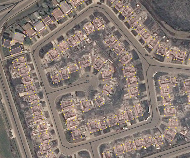
Thanks everyone. — Dale Kunce | Senior Geospatial Engineer and GIS Team Lead | International Services | American Red Cross 2025 E Street NW, Washington, DC 20006 Tel 202.303.4095 | Cell 510.842.7523 | Skype dkunce From: Dan Joseph <[email protected]<mailto:[email protected]>> Date: Sunday, May 15, 2016 at 7:00 PM To: Denis Carriere <[email protected]<mailto:[email protected]>> Cc: Talk-CA OpenStreetMap <[email protected]<mailto:[email protected]>> Subject: Re: [Talk-ca] Red Cross and Fort McMurray Fires Hi, that url looks like the one from the gov't of Alberta web viewer. If that's the case it pretty clearly states on the welcome page (emphasis mine): Satellite image source: Pléaides-1A © CNES 2016, Distribution AIRBUS DS, all rights reserved. Use of this imagery is subject to the Airbus Defence and Space Web License for Non-Commercial Use, January, 2015. Users may view the image; must not download, store, copy, transfer or reverse engineer the image in any way or use the image to create a database and/or a derivative work; and must contact AIRBUS DS to obtain a full license. Base Map Data provided by the Government of Alberta under the Alberta Open Government Licence. Cadastral and Dispositions Data provided by Alberta Data Partnerships. Other data are provided by the ministry of Alberta Environment and Parks (AEP). No base feature data can be reproduced or distributed without the prior written permission of the Government of Alberta. Can you please clarify the source of the imagery and the licensing around it? On Sun, May 15, 2016 at 2:09 PM, Denis Carriere <[email protected]<mailto:[email protected]>> wrote: If anyone is interested in using this custom imagery in JOSM or iD, here is the URL: https://cdn.albertamapservices.ca/genesis_tokenauth/rest/services/Pleiades_RGB_Ft_McMurray_Fire_50cm/20160506/MapServer/tile/{zoom}/{y}/{x}<https://cdn.albertamapservices.ca/genesis_tokenauth/rest/services/Pleiades_RGB_Ft_McMurray_Fire_50cm/20160506/MapServer/tile/%7Bzoom%7D/%7By%7D/%7Bx%7D> You can clearly see the damaged buildings: https://pbs.twimg.com/media/CihrvYmU4AALP5N.jpg:large ~~~~~~ Denis Carriere GIS Project Manager Twitter: @DenisCarriere<https://twitter.com/DenisCarriere/> OSM: DenisCarriere<https://www.openstreetmap.org/user/DenisCarriere> GitHub: DenisCarriere<https://github.com/DenisCarriere> Email: [email protected]<mailto:[email protected]> On Sun, May 15, 2016 at 1:40 PM, Dan Joseph <[email protected]<mailto:[email protected]>> wrote: Hi James, What was the source for the traced damage extent estimates? I was cross-referencing between the satellite imagery the Alberta government has made available for viewing at https://cdn.albertamapservices.ca/FortMcMurray/ and the extent polygons up on OSM tagged name="Fort McMurray Fire Damage Estimate" and there seemed to be differences. Also, I can't find the source now, but remember hearing that no schools were destroyed but am seeing several schools in the OSM damage extent polygons. Thanks and all the best, Dan On Fri, May 13, 2016 at 5:16 PM, James <[email protected]<mailto:[email protected]>> wrote: Hello everyone OsmCanada had a meeting tonight and have traced polygons estimating the areas damaged and have named them "Fort McMurray Fire Damage Estimate". They are tagged as brownfield as the buildings have been destroyed or burnt down. The major areas affected are Thickwood, Beacon Hill and Abasand. We thought this may help the red cross immensely. Big thank you to Rps333 for the help. On Fri, May 13, 2016 at 2:56 PM, Dan Joseph <[email protected]<mailto:[email protected]>> wrote: Hi John, Dale is the American Red Cross GIS Team Lead. I'm on his team and have been deployed to Canada to work in-person with the Canadian Red Cross. In terms of OSM-CA / Red Cross coordination, I can be considered the point of contact on the RC side until someone within Canadian Red Cross is ready and willing to take it on. All the best, Dan On Fri, May 13, 2016 at 2:44 PM, john whelan <[email protected]<mailto:[email protected]>> wrote: Have you talked to [email protected]<mailto:[email protected]>? A coordinated approach might be better. OSM can use data obtained through the Gov Canada open data portal and has done in the past as far as I am aware. Thanks John On 13 May 2016 at 14:37, Dan Joseph <[email protected]<mailto:[email protected]>> wrote: Hi James, It looks like some good progress is being made on the tasks. Tasks #22 and #23 are focused on mapping different features but it looks like #24 overlaps in focus. Perhaps that task should be archived until the other two are completed to avoid confusion among newcomers to the site? Task #23 only provides minimal instructions (Add address data via GeoBase. Add missing Roads and Street names.). Would more people feel comfortable contributing if detailed instructions were included? It seemed the task is referring to the dataset described here: http://ftp2.cits.rncan.gc.ca/pub/geobase/official/nrn_rrn/doc/NRN.pdf Is the Canada open government licence compatible with OSM? Thanks and all the best, Dan On Fri, May 13, 2016 at 2:21 PM, James <[email protected]<mailto:[email protected]>> wrote: What exactly do you need of me? Prioritize areas to get mapped? We have tasks for the buildings, addresses and streets(which I think have been imported via CanVec) and a validation layer On Fri, May 13, 2016 at 2:14 PM, Dan Joseph <[email protected]<mailto:[email protected]>> wrote: Hi everyone, I'm helping coordinate the Canadian Red Cross' use of GIS in their activities responding to the Fort McMurray fires. Staff has been very busy but we're ramping up and exploring options for how to leverage different tools and data sources to support the Red Cross operations. The focus is on the evacuees, many of which have dispersed to distant locations around the country. When residents are allowed to return to the town and longer-term recovery activities become a priority, I foresee having an excellent OSM base layer as being a valuable asset. Both for facilitating operational decisions, and demonstrating the power of the OSM community and easily accessible geo-data with an open license! I would love to connect with those involved in coordinating the current tasks up on http://tasks.osmcanada.ca/. Is the best channel of communication through this list or via Skype or some other means? All the best, Dan Joseph GIS Officer | International Services | American Red Cross Skype danielbjoseph | Twitter @danbjoseph | OSM ID danbjoseph _______________________________________________ Talk-ca mailing list [email protected]<mailto:[email protected]> https://lists.openstreetmap.org/listinfo/talk-ca -- 外に遊びに行こう! _______________________________________________ Talk-ca mailing list [email protected]<mailto:[email protected]> https://lists.openstreetmap.org/listinfo/talk-ca -- 外に遊びに行こう! _______________________________________________ Talk-ca mailing list [email protected]<mailto:[email protected]> https://lists.openstreetmap.org/listinfo/talk-ca
_______________________________________________
Talk-ca mailing list
[email protected]
https://lists.openstreetmap.org/listinfo/talk-ca