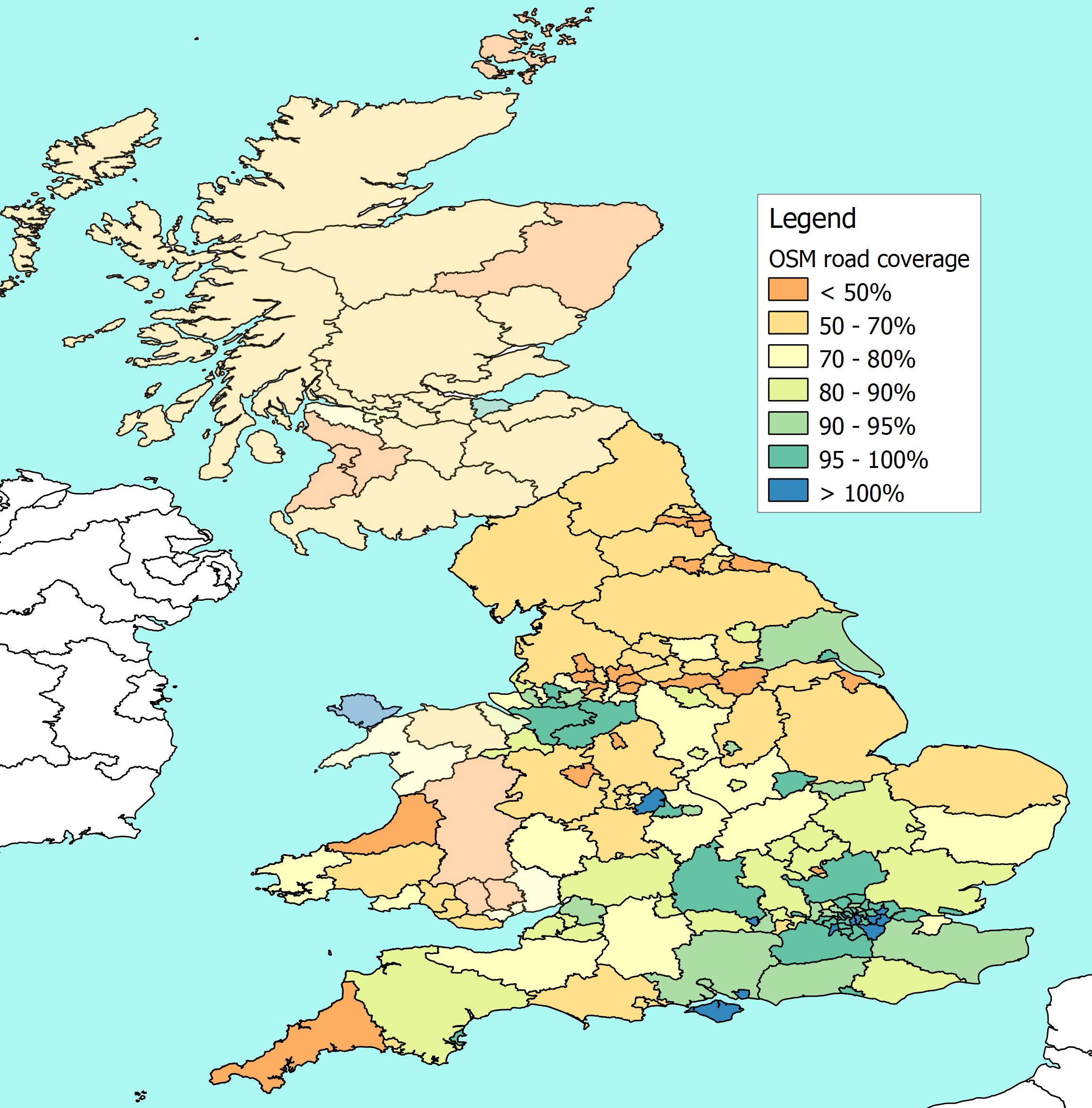
Last week I posted a note about my efforts to compare actual road lengths
(or at least Department for Transport statistics)  against the lengths of
road that are now in the map for each local authority area in England.
This is a quick follow-up on the discussion that resulted, and an update on
progress since.


Thanks to all the useful suggestions, I've now managed to find and fix a
number of areas where my analysis was double counting.

I've also improved the way different highway tags are translated so that I
match the DfT statistics more accurately.

I've discovered and cleared a few problems with the process that resulted in
data getting lost along the way, so my figures are now more complete.


However, I still haven't managed to pick up all the admin boundaries that I
should be getting, and I'm still using some ceremonial boundaries in place
of the administrative ones.

That skews the results in places like Buckinghamshire and Kent, where roads
within a unitary authority are still counted inside the neighbouring county.


Alongside fixing things, I've tried to tidy up my extract and load so that
they are more robust and easier to manage (my steep learning curve on
Postgresql and Postgis continues).


There is a first crude attempt at plotting it all here -
http://www.reedhome.org.uk/Documents/OSMCover.png


This isn't a definitive result, of course - or even close to one. There are
still gaps that shouldn't be there, and more checking to do.


Meanwhile, thanks for the encouragement, Pete
_______________________________________________
Talk-GB mailing list
[email protected]
http://lists.openstreetmap.org/listinfo/talk-gb