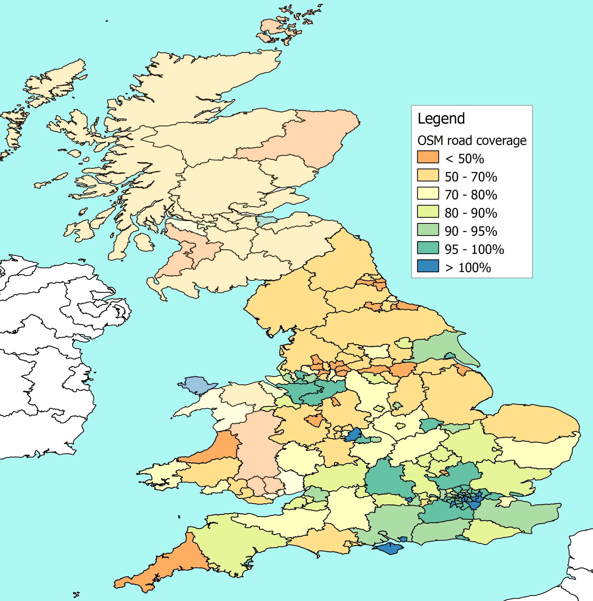
I have done some preliminary measures of OSM coverage for Scotland and Wales
based on using NUTS-3 regional boundaries as common ground to compare DfT
figures for the length of roads in a local authority against the length of
roads in OSM.
NUTS-3 is the basis for EU regional statistics, and they publish the
boundaries as shapefiles. The precision isn't as great as you get from admin
boundaries on OSM, but there are missing admin boundaries in Scotland and
Wales, so this is a kind of stop-gap.


On the whole the boundaries match up reasonably well, and where they don't
exactly correspond, I  can normally aggregate the road length statistics for
a few authorities to get the figure for the equivalent NUTS region. It's
only in the Scottish highlands where this doesn't work too well. Bascially
the local authority for the Highlands crosses several NUTS regions, so I've
had to take average figures to cope with boundaries that are not aligned.


I realise the colouring could do with some work to make it more clear, but
first version of the resulting map is here -
http://www.reedhome.org.uk/Documents/OSMCover.png


The headlines are that Anglesey and Edinburgh look well covered. Glasgow,
Renfrewshire, Gwynedd are pretty good. While Powys, Aberdeenshire, Orkney
and Shetland are looking a bit thin.


For anyone interested in doing a similar exercise elsewhere in Europe, there
are Eurostat figures for road lengths at the NUTS-2 level (i.e. the next
largest geographical grouping after those I am using here).


Eurostat only split "Motorways" and "Other Roads" so dealing with dual
carriageways etc is going to be a bit iffy. However, I've done a quick
comparison of their numbers for the UK, and the rough figures ((motorways *
2) + other roads) gives me a total that isn't a million miles away my more
detailed calculations.


The Eurostat figures are here -
http://epp.eurostat.ec.europa.eu/portal/page/portal/region_cities/regional_s
tatistics/data/database under "Regional Transport Statistics".
_______________________________________________
Talk-GB mailing list
[email protected]
http://lists.openstreetmap.org/listinfo/talk-gb