NPE maps have always had major alignment problems which have seemed to
me to be worse in the eastern side of the country. There's also a new
problem, but I don't know whether it is in the JOSM WMS plugin, the tile
server or what.
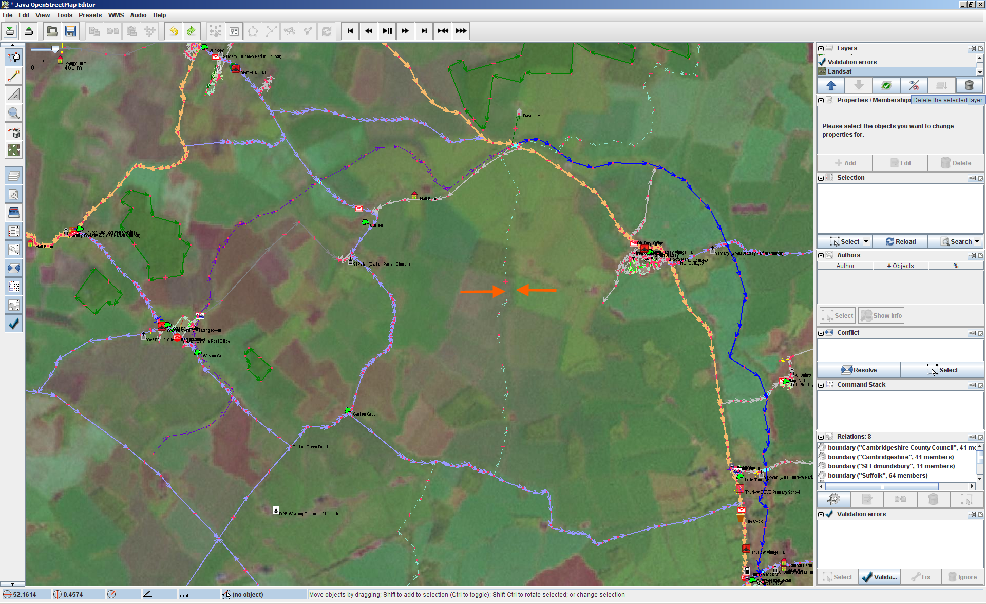
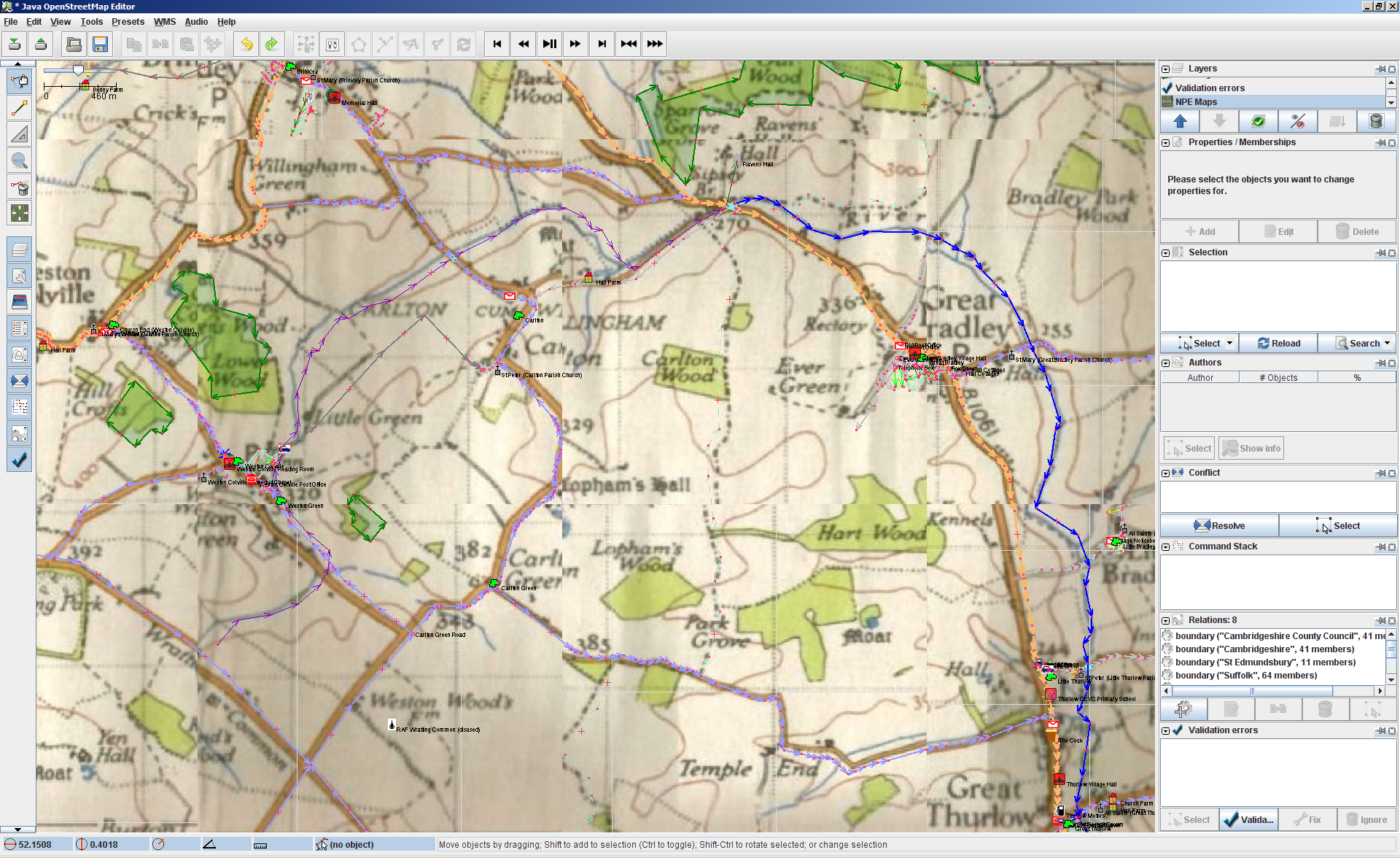
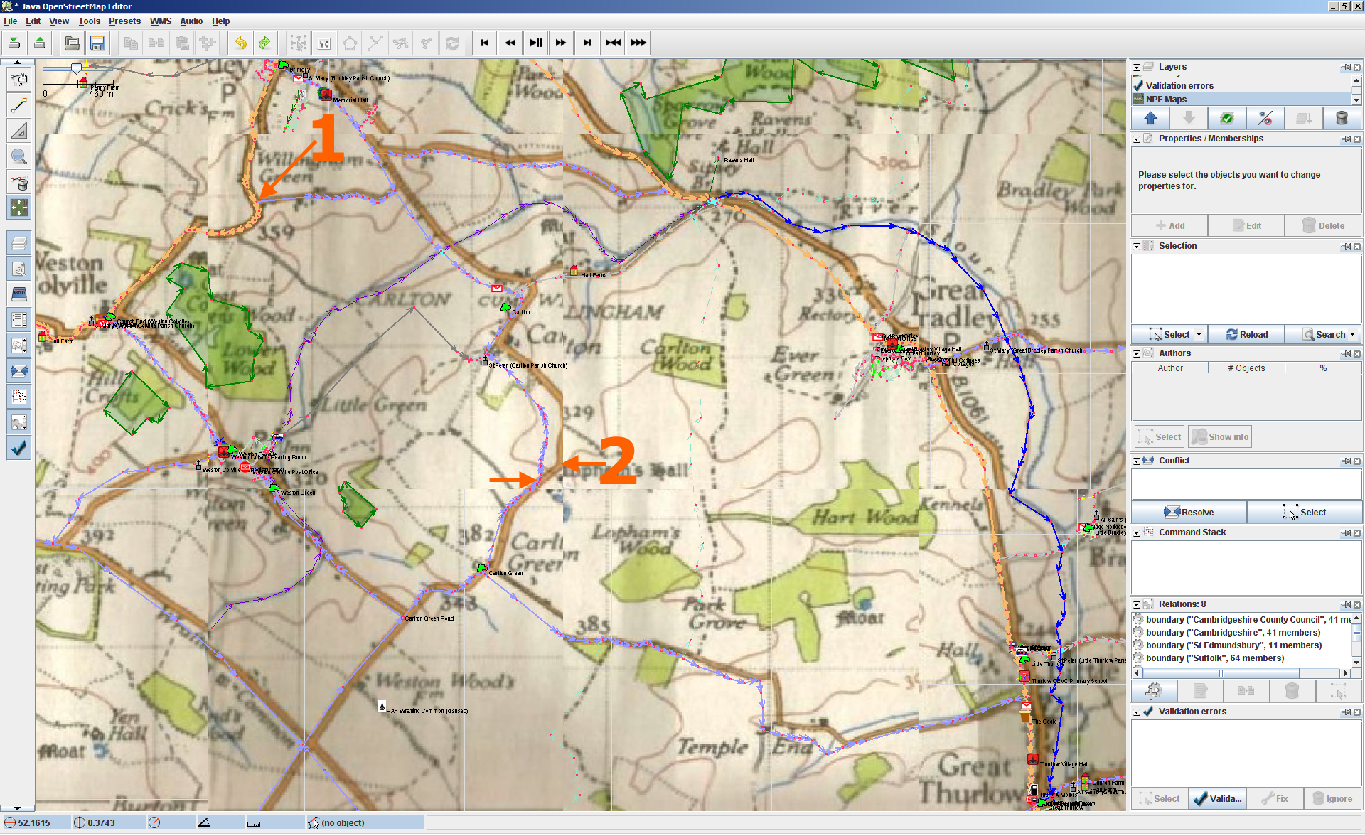
Consider three JOSM screenshots:
http://www.frankieandshadow.com/xref/josm1.png
http://www.frankieandshadow.com/xref/josm2.png
http://www.frankieandshadow.com/xref/josm3.png

The first is Landsat, obviously. It defaults with an offset of about
100m vertically and horizontally in my part of the world (52N 0E) as can
be seen from the obvious course of the road on the satellite images at
the orange arrows. But once the layer is aligned on known points, it
tends to be aligned across the whole working area.

NPE maps in contrast, in the second one, firstly has a relative
displacement of tiles (about 150m) in JOSM which is obvious in this
unadjusted download. (We also have to add to that that the map sheet
boundaries don't line up anywhere near accurately)

The third one though shows that even within a single tile, the alignment
drifts extremely rapidly. I aligned the third one with the junction at
point 1 near the top left of a tile, and you can see that at the bottom
right of the tile, the bend I've marked is off by about 150m
horizontally and 115m vertically over a distance of about 1500m - 10%.
All the roads in this area are GPS surveyed (I did them).

I mentioned this when NPE maps first arrived, but it's never been
addressed. Is it a rectification problem, or a problem of how JOSM or
the WMS plugin scales or displays the tiles?

The tile displacement problem is recent and I'm sure that will easily be
fixed. The variation across a tile is more awkward I think.

David


_______________________________________________
Talk-GB mailing list
[email protected]
http://lists.openstreetmap.org/listinfo/talk-gb