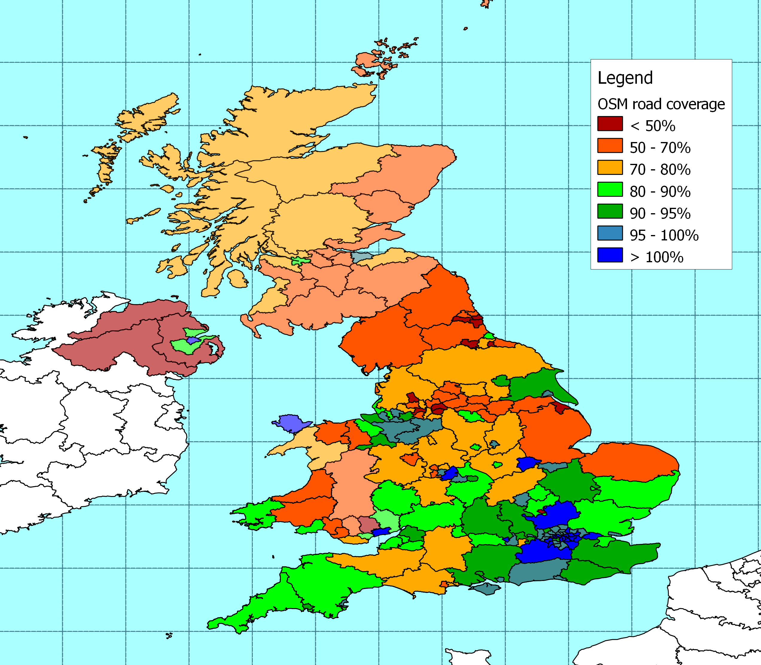
I've now updated the coverage spreadsheet and map for Scotland, the rest of
Wales  and Northern Ireland.
http://www.reedhome.org.uk/Documents/OSMCoverMar2010.png


http://www.reedhome.org.uk/Documents/OSMCoverMar2010.csv


It's the first time I've tried to add N. Ireland. I can't find local
authority boundaries for N. Ireland, and I believe they are changing soon
anyway, so as in Scotland and parts of Wales the calculations are done at
the regional level using NUTS3 boundaries.

It shows that coverage is concentrated around Belfast, which is not a big
surprise.


The spreadsheet holds some data for the Republic of Ireland as well. I've
measured the lengths of roads in OSM, but I can only find comparable
government statistics on the national road network in Ireland.

If anyone is interested, and knows where there are statistics on the local
road network in Ireland then I'll be happy to add them in.


I'm not planning to do any more fiddling with the boundaries in England
until we see what comes out of ONS, but the Isle of Man is on the "To do"
list.
_______________________________________________
Talk-GB mailing list
[email protected]
http://lists.openstreetmap.org/listinfo/talk-gb