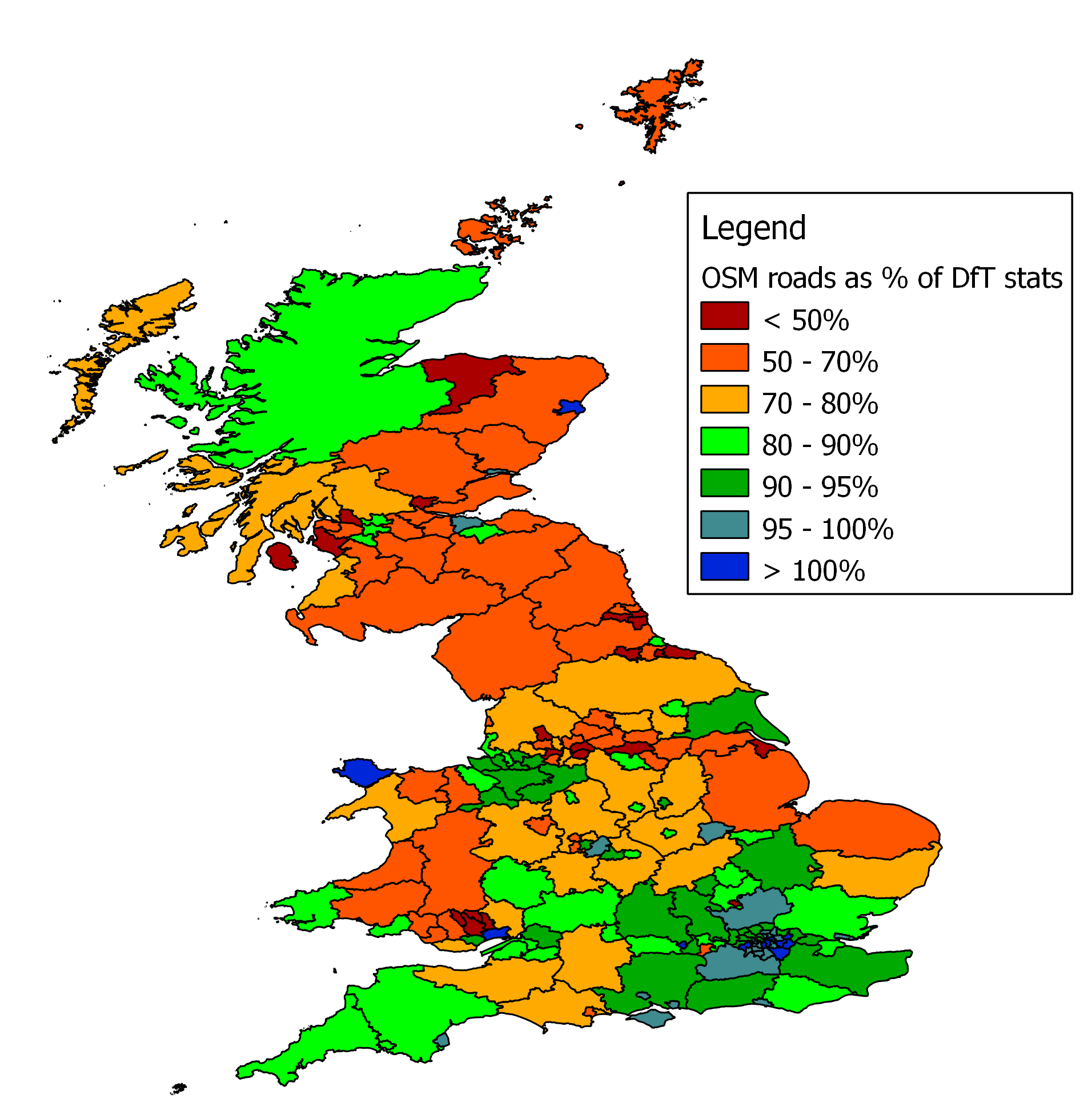
There is more sophisticated analysis of OSM coverage using OS vector data
(http://povesham.wordpress.com/2010/04/04/openstreetmap-completeness-evaluat
ion-march-2010/ ), but for what it's worth, I have produced another simple
comparison between DfT statistics and the length of roads plotted on OSM.
My previous attempts used OSM boundary data to isolate each local authority,
but this one uses OS boundary data for each local authority in Great
Britain. Boundaries for Northern Ireland are not included in the OS data as
far as I can see, so they do not appear.


Within each authority I measure the length of roads of each type, then
compare them to the statistics published by the Department for Transport.


The results are here -
http://www.reedhome.org.uk/Documents/OSMCoverOSApr2010.png for the image,
and the data is here -
http://www.reedhome.org.uk/Documents/OSMCoverOSApr2010.csv


The eagle-eyed might notice that I have simplified the boundaries to speed
plotting of the image, but the original calculations were done on the full
OS boundary detail.


The results differ slightly from my previous attempts at doing this using
OSM boundary data. Partly this will be due to the new boundaries, but I have
also been more stringent in classifying roads that have ambiguous tags.


With ward boundaries now available from OSM, I'm hoping that I can now take
some of this to a more detailed level
_______________________________________________
Talk-GB mailing list
[email protected]
http://lists.openstreetmap.org/listinfo/talk-gb