Hi Nick & Luke,

Luke Smith wrote:
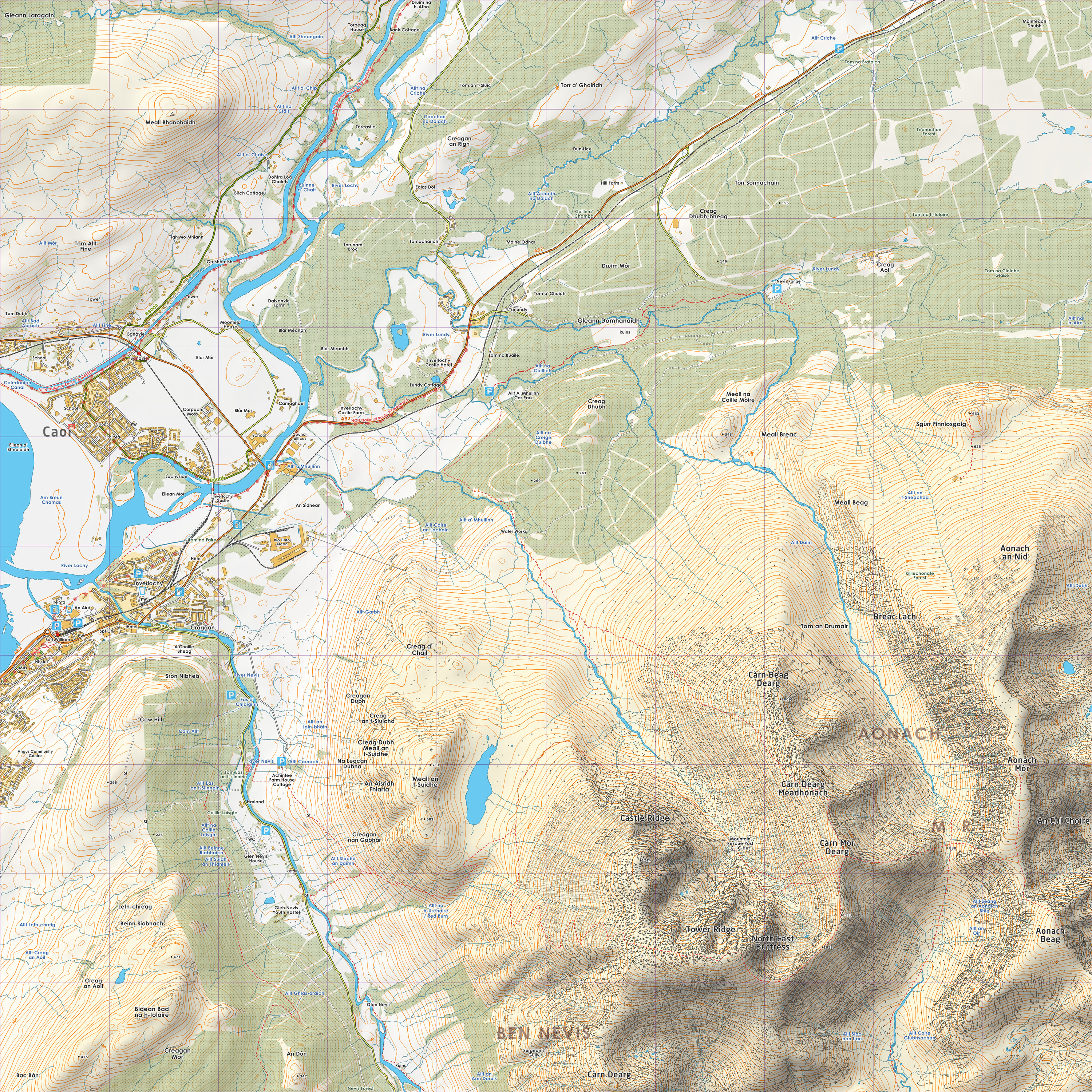
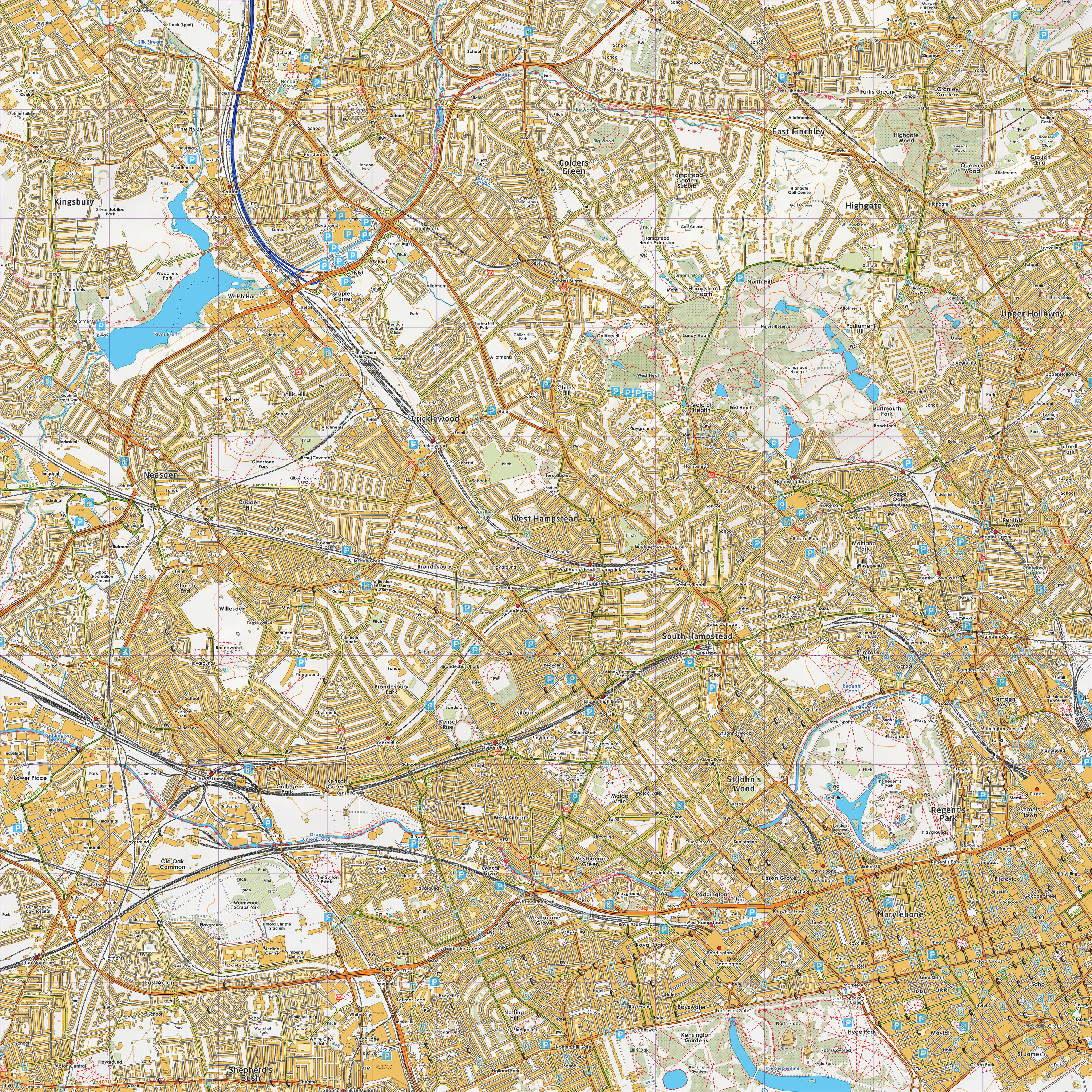
Funnily enough I've been working on something similar now for a while.
It's not perfect and needs a bit more work, but I've uploaded a couple
of tiles (one London, the other Ben Nevis).
http://www.grough.co.uk/lib/documents/tmp/lss/nn17.jpg
http://www.grough.co.uk/lib/documents/tmp/lss/tq28.jpg
That's been put together using a mixture of OS StreetView (buildings),
OS VectorMap District (roads, forests, water, crags), OS Landform
Panorama (contours, relief), OS BoundaryLine (civil parish names), OS
Strategi (national park boundaries, mountain range names) and
OpenStreetMap (point names, footpaths, parks, schools etc).
Here are some of mine:

    http://chezphil.org/tmp/vectormap/lakes_small.jpeg
    http://chezphil.org/tmp/vectormap/borrowdale.jpeg
    http://chezphil.org/tmp/vectormap/3dlakes.jpeg

What tags are you each using to extract OSM footpaths, tracks etc?
When I tried to do this, I found it difficult to get right: if you
include too much you end up overlaying e.g. tracks on top of things
that are shown on the OS data, and if you include less you miss
things. For example, Luke, I notice that you have tracks near the Fort
William distillery that I don't have. Last time I used something like
this (PSEUDO-CODE):
    if (highway=="track") {
      path_type += track;
    }
    if (highway=="bridleway" || horse=="yes" || designation=="public_bridleway"
        || highway=="cycleway") {
      path_type += bridleway;
} else if (highway=="footway" || foot=="yes" ||
designation=="public_footpath") {
      path_type += footpath;
    } else if (horse=="permissive") {
      path_type += permissive_bridleway;
    } else if (foot=="permissive") {
      path_type += permissive_footpath;
    } else if (highway=="path") {
      path_type += path;
    }
Luke, do the "BEN NEVIS" and "AONACH MOR" labels come from Strategi?
I've not looked at that. Bizarrely, the VectorMap data doesn't seem to
have the name "Ben Nevis" at all; many other large mountains are also
missing or mis-placed and too small. I am hoping that this sort of
thing will be fixed in their next release (when will that be?), but if
not, maybe using the Strategi data is one possibility.
Cheers,  Phil.


_______________________________________________
Talk-GB mailing list
[email protected]
http://lists.openstreetmap.org/listinfo/talk-gb