On 01/11/2015 17:53, Richard Fairhurst wrote:
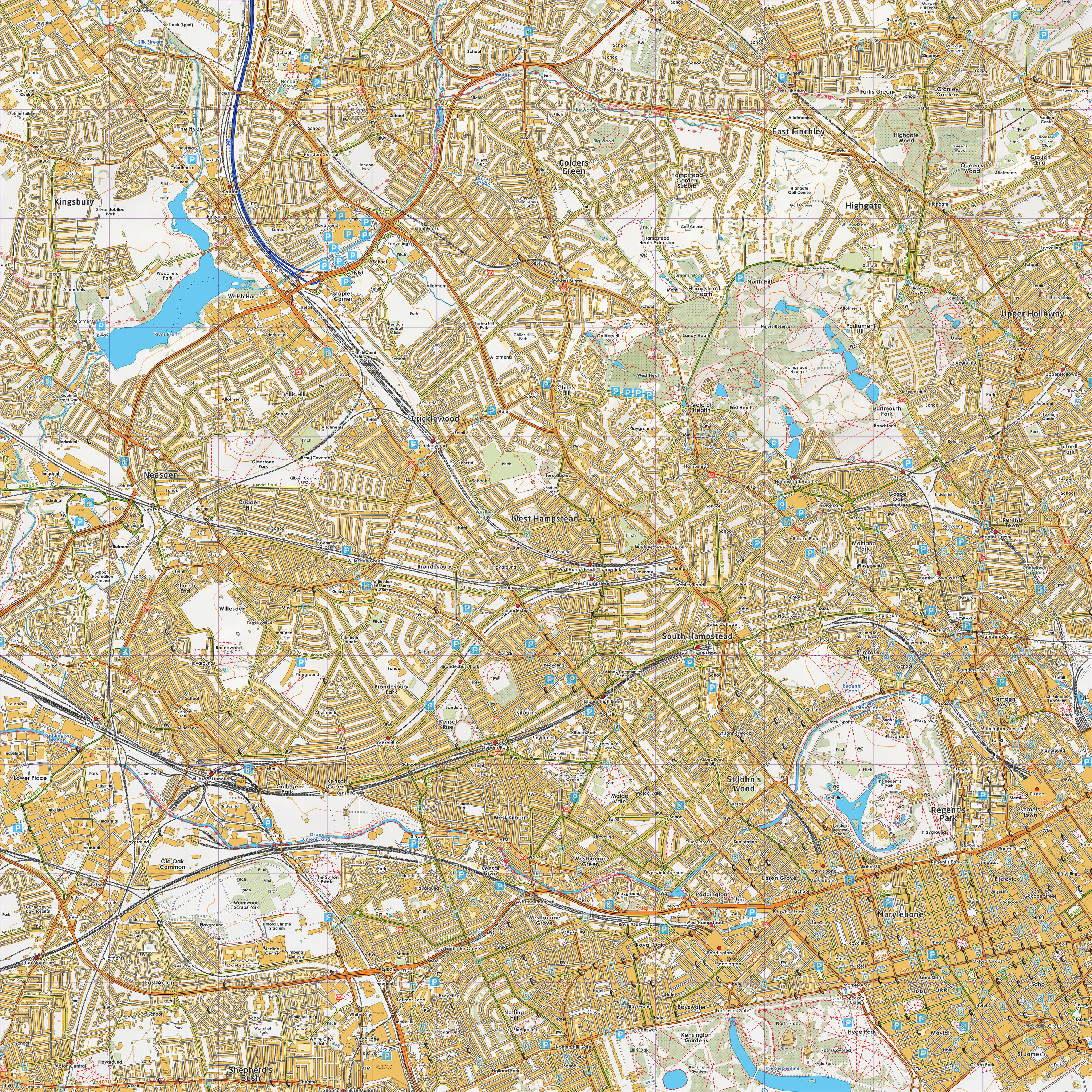
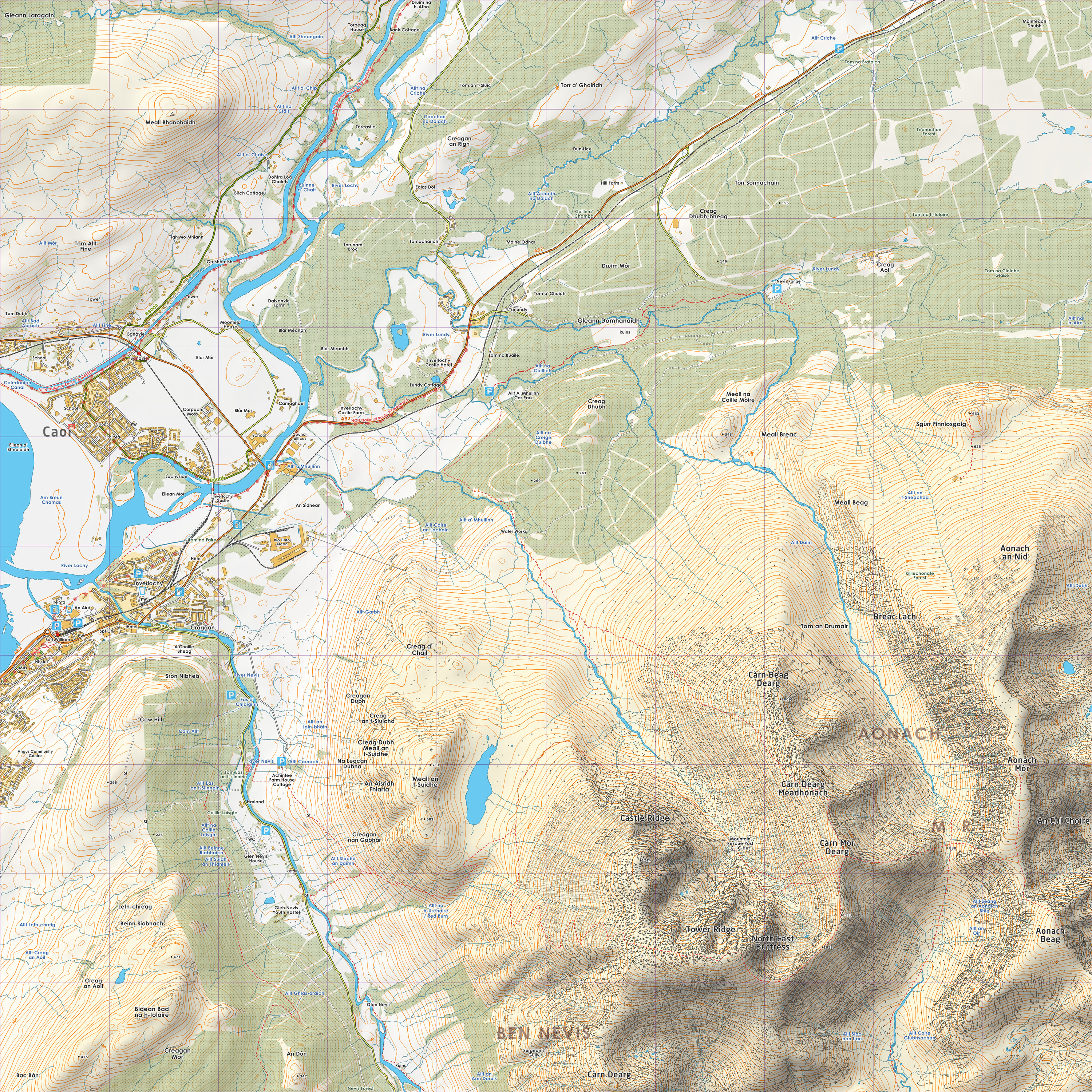
Back in 2011, Luke Smith from Grough posted a terrific example to this list
of a style he'd been working on, combining OSM and OS OpenData:

     http://www.grough.co.uk/lib/documents/tmp/lss/tq28.jpg
     http://www.grough.co.uk/lib/documents/tmp/lss/nn17.jpg
That's nice. That's really, really nice.
Maybe someone here will be inspired to do something good like that. Maybe I
will, though the constant grousing and moaning isn't exactly inspiring me
with hope that it would be a pleasant endeavour. Or maybe the Mappa Mercia
guys might accelerate their plans for an England & Wales chapter and secure
a little bit of funding to pay for one of us cartographers to spend a few
days on it!
It needs the eye of someone with proper cartography training.
Part of the problem here, with the emphasis on "OSM is data" is that
we're approaching the visual aspect with a programming mindset. In
particular, focusing on how easy it it is to set up and run your own
tileserver tends to spectacularly miss the point that the really hard
part of a DIY approach is coming up with an effective, clear and
intuitive style. That's something that professional cartography
organisations, such as OS, Bartholomew and Geographers, spend lots of
time and money to get right. It's equally a skillset that Google and
Bing clearly do not possess on their mapping teams. And it's probably
something that is very, very difficult to do collaboratively, because
committees always tend to the least objectionable rather than the most
effective.
Mark


_______________________________________________
Talk-GB mailing list
[email protected]
https://lists.openstreetmap.org/listinfo/talk-gb