Here's a tracker of progress in getting the route relations set up.  You might
also update this as you add the new segments.
https://wiki.openstreetmap.org/wiki/England_Coast_Path
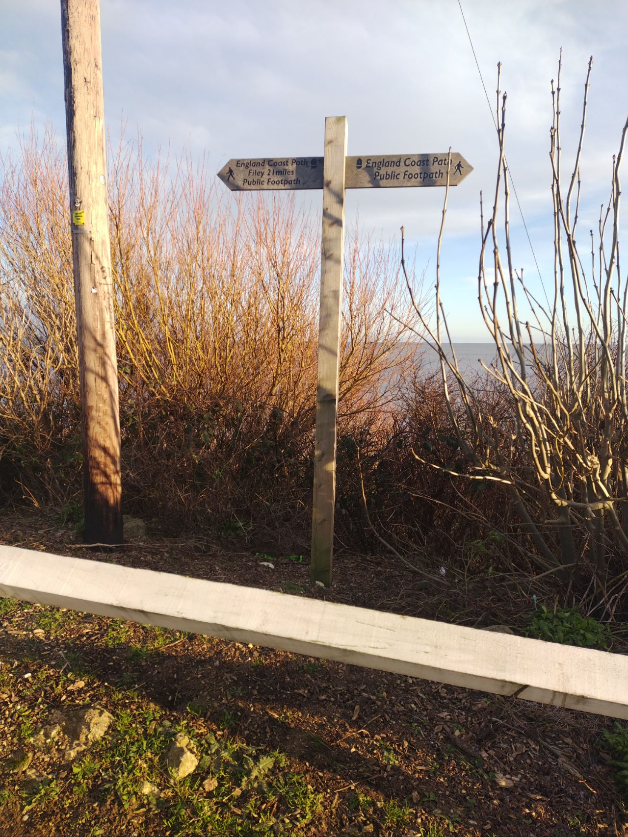
---
https://hdyc.neis-one.org/?spiregrain
[email protected]

On Mon, 3 Feb 2025, at 1:12 PM, Andy Townsend wrote:
> On 03/02/2025 12:42, Chris Smith wrote:
>>
>> Easy enough for me to add a footpath, but it made me wonder how the whole of
>> this Path will become a route, appropriately labelled. Can someone enlighten
>> me?
>>
> Hello,
>
> Log distance paths tend to be added to OSM as route relations.  This one is
> quite long, and is split into a separate relation for each piece.
>
> Here's the "superroute" relation:
> https://www.openstreetmap.org/relation/3971851 (that's an OSM relation
> containing other relations).
>
> Taking one of those as an example (one that I visited a couple of weeks ago):
> https://www.openstreetmap.org/relation/16312445 , that in turn is made up of
> individual sections of footpath such as
> https://www.openstreetmap.org/way/1352774195 .  Adjacent to that is a
> guidepost https://www.openstreetmap.org/node/12496741581
> https://map.atownsend.org.uk/tmp/256804.jpg that I've also added to that
> relation.
>
> Generally speaking, you'll want to add your new bit of path to the local bit
> of England Coast Path relation.  That might be
> https://www.openstreetmap.org/relation/18268797 or perhaps
> https://www.openstreetmap.org/relation/17245344 to the north.  In the iD
> editor there's an "add to relation" option below the tags section at the
> bottom left of the screen - the tricky bit is to make sure that you're adding
> to your local section and not the "superroute".
>
> The canonical visualiser for these sorts of things is Waymarked Trails
> https://hiking.waymarkedtrails.org/#?map=9.0/53.5451/-3.066 - you can see the
> bits of ECP that it knows about labelled as such.
>
> In addition to that I also show them on maps such as
> https://map.atownsend.org.uk/maps/map/map.html#21/54.09243/-0.17708 and the
> equivalent vector map
> https://map.atownsend.org.uk/vector/index.html#20/54.0924304/-0.1770821 also
> shows which route each guidepost is part of - the southern one is the England
> Coast Path, the northern one is for a couple of cycle routes.
>
> Best Regards,
>
> Andy
>
>>
> _______________________________________________
> Talk-GB mailing list
> [email protected]
> https://lists.openstreetmap.org/listinfo/talk-gb
>
_______________________________________________
Talk-GB mailing list
[email protected]
https://lists.openstreetmap.org/listinfo/talk-gb