Janko, hvala ti za iscrpne informacije. Pozdrav od slovenskih mapera :)

Igor
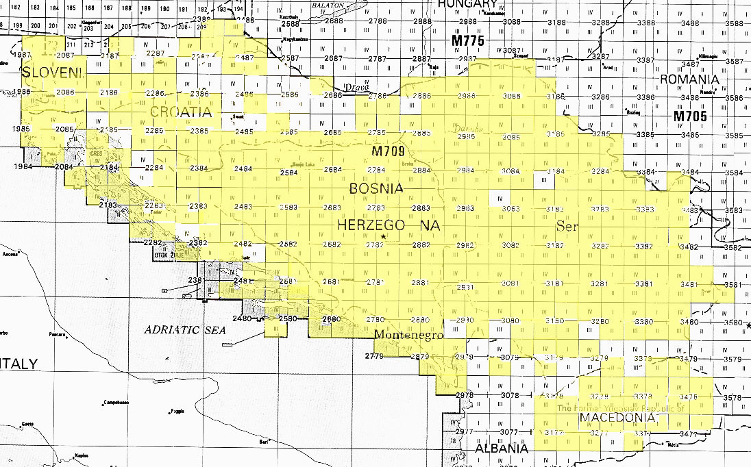
2012/1/17 Janko Mihelić <jan...@gmail.com>

> ---(English version at the bottom of e-mail!)---
>
> Pozdrav od hrvatskih mapera!
>
> Američka  institucija U.S. Geological Survey je objavila karte cijelog
> područja  bivše Jugoslavije pod public domain licencom, što znači da ih
> možemo koristiti na Openstreetmap projektu. Izjava o licenci na
> slijedećem linku:
> http://www.lib.utexas.edu/maps/faq.html#3.html
> Lista sa pdf-ovima ovdje:
> https://www.lib.utexas.edu/maps/topo/former_yugoslavia/
> Nažalost nisu skenirane sve karte, žuto su obojane regije sa podlogama:
> http://www.lib.utexas.edu/maps/topo/former_yugoslavia/index_map.jpg
> Vidi se da Hrvatska i Slovenija nemaju baš puno, ali treba i ovo
> iskoristiti.
>
> Naš član dodobas je geokodirao karte i stavili smo ih na server kojeg
> održava korisnik hbogner na Geodetskom fakultetu u Zagrebu.
> Zato vas pozivamo da koristite te podloge kako bi popunili Openstreetmap
> projekt sa što više korisnih podataka!
>
> Predlažem da se za elemente ucrtane preko tih podloga koristi tag *source=U.S.
> Defense Mapping Agency *kako bi lako našli što je mapirano sa tim kartama.
>
> Kako ih koristiti?
>
> U JOSMu:
> Kliknuti na Edit > Preferences... > WMS TMS > + (Plus dolje desno) > TMS
>
> Menu name= *U.S. Defense* osm-hr
> TMS URL= http://tms.osm-hr.org/1.0.0/all_ustopo/{zoom}/{x}/{y}.png
>
> Screenshot: http://
> <http://osm-hr.org/josm.png>osm-hr.org/josm<http://osm-hr.org/josm.png>
> .png <http://osm-hr.org/josm.png>
>
> U Potlatchu:
> Kliknuti na Background > Edit...
> I napraviti novi upis:
>
> Name= *U.S. Defense* osm-hr
> URL= http://tms.osm-hr.org/1.0.0/all_ustopo/$z/$x/$y.png
>
> Screenshot: *http://osm-hr.org/potlach.jpg*<http://osm-hr.org/potlach.jpg>
>
> Ako ima problema, javite nam se!
>
> http://osm-hr.org/
>
> P.S.
> Pripazite na loše podatke koji će se zbog promjene licence brisati 1.
> Aprila. Više o tome na wiki stranici o Remapiranju:
> http://wiki.openstreetmap.org/wiki/Hr:Remapping
>
> *English*
>
> *New **imagery*
>
> Hi from croatia mappers!
>
> The U.S. Geological Survey has made public maps of the whole Ex Yugoslavia
> under the Public Domain license, which means we can use them in the
> Openstreetmap project. Statement about the license on the following link:
> http://www.lib.utexas.edu/maps/faq.html#3.html
> List of maps in pdf format here:
> https://www.lib.utexas.edu/maps/topo/former_yugoslavia/
> Unfortunately, not all maps are scanned, the yellow areas are available:
> http://www.lib.utexas.edu/maps/topo/former_yugoslavia/index_map.jpg
> It's obvious that Croatia and Slovenia don't have much, but it should be
> used.
>
> Our member dodobas geocoded the maps and we put them on the server
> maintained by user hbogner on the Faculty of Geodesy in Zagreb.
> We are inviting you to use the imagery to fill the Openstreetmap with as
> much usefull data possible!
>
> I suggest you use the tag *source=U.S. Defense Mapping Agency *for the
> elements drawn over these backgrounds so we can easily find what is drawn
> with these maps.
>
> How to use them?
>
> In JOSM:
> Go to Edit > Preferences... > WMS TMS > + (Plus sign lower right) > TMS
>
> Menu name= USGS osm-hr
> TMS URL = http://tms.osm-hr.org/1.0.0/all_ustopo/{zoom}/{x}/{y}.png
>
> Screenshot: http://
> <http://osm-hr.org/josm.png>osm-hr.org/josm<http://osm-hr.org/josm.png>
> .png <http://osm-hr.org/josm.png>
>
> In Potlatch:
> Go to Background > Edit...
> Make a new line:
>
> Name= USGS osm-hr
> URL= http://tms.osm-hr.org/1.0.0/all_ustopo/$z/$x/$y.png
>
> Screenshot: *http://osm-hr.org/potlach.jpg*<http://osm-hr.org/potlach.jpg>
>
> If there are any problems, contact us!
>
> http://osm-hr.org/
>
> P.S. Watch out for bad data that is going to be erased because of the
> license change on April 1. More about that on the page about Remapping:
> http://wiki.openstreetmap.org/wiki/Remapping
>
> _______________________________________________
> Talk-si mailing list
> Talk-si@openstreetmap.org
> http://lists.openstreetmap.org/listinfo/talk-si
>
>
_______________________________________________
Talk-si mailing list
Talk-si@openstreetmap.org
http://lists.openstreetmap.org/listinfo/talk-si