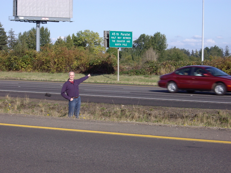
I got Caney and Coffeyville backwards.  They're roughly midway between
Coffeyville, KS and South Coffeyville, Oklahoma on US 169, IIRC (
http://www.openstreetmap.org/?relation=129916#map=13/37.0054/-95.6294).  I
know when I saw them, they were surprisingly far south for what I thought.
 I strongly suspect KDOT has posted a number of conflicting landmarks
(similar albeit slightly less inconsistent situation would be ODOT's
posting of 45th Parallel signs, many of which, particularly in the desert,
are off by up to a mile, and likely posted in the wrong spot intentionally
to give tourists a spot to pull out and stop; you learn to hate the
tourists that stop at the accurate ones because they're putting you and the
rest of the public in danger, like this moron standing in the middle of I 5
near Keizer, Oregon: http://confluence.org/us/or/n45w123v7/pic2.jpg)
On Fri, Nov 15, 2013 at 5:56 PM, Tod Fitch <[email protected]> wrote:

> If those KDOT signs are near Meades Ranch then they are likely correct.
>
> https://en.wikipedia.org/wiki/Meades_Ranch%2C_Kansas
>
> --
> Sent from my mobile device. Please excuse my brevity.
>
> Paul Johnson <[email protected]> wrote:
>>
>> On Friday, November 15, 2013, wrote:
>>
>>>  Seeing as how the “official” location of the lower 48’s centroid is in
>>> north-central Kansas, I’d have to dispute your claim that Tulsa is the
>>> closest major metro area. Looks to me that Lincoln, Nebraska would be the
>>> closest. There’s also Wichita, Omaha, Topeka, and Kansas City.
>>>
>>
>> Just going by the claims of some random KDOT sign along US 169 nearish
>> Caney, stating it's at the geographic center of the lower 48th.
>>
>> ------------------------------
>>
>> Talk-us mailing list
>> [email protected]
>> https://lists.openstreetmap.org/listinfo/talk-us
>>
>>
_______________________________________________
Talk-us mailing list
[email protected]
https://lists.openstreetmap.org/listinfo/talk-us