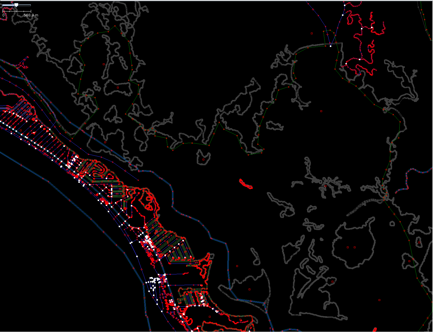
User Eraque22 asked on help.osm.org what the issue is with Estero Bay
since no water was rendered there. I added a multipolygon to the
existing multiple segments of natural=water (not created by Eraque22) so
that the water started to get rendered and answered the question¹.
The next thing I realised the rendering seemed to stop again.
Then I saw the user had deleted all the natural=water ways and nearly
all islands and started to draw them anew in mostly worse quality then
before. Of course a lot is missing.

I send him a message asking for the reason of the deletions. Though he
was mapping all the time - as I realised the deletions, as I send the
message and still two hours after I sent it - there was no answer.

What to do? Hope he draws it all anew quite good?
malenki

¹
https://help.openstreetmap.org/questions/17440/disappearing-coastal-water

Screenshot, grey lines are deleted data:
http://malenki.ch/OSM/Bilder/2012-11-04_214311_scr_Estero_Bay_1.png

Example for deletions:
http://www.openstreetmap.org/browse/relation/2549516/history


_______________________________________________
talk mailing list
[email protected]
http://lists.openstreetmap.org/listinfo/talk