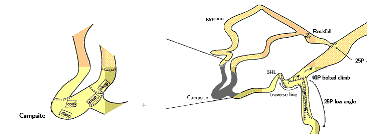
My trusty Therion lackey Michael has been working on enlarged offsets to
show greater detail in some locations, and came up with the process of
exporting a map with the enlarged detail, then inserting the pdf created as
a map-image as in the example below.
Quite good lateral thinking I thought, but it lacks somewhat in precise
control of where the image is inserted and connection points of course do
not work.


Does anyone have any alternative ideas for how to do this?

Would offsets with  a scale factor be an option for the future release?

Bruce


  _____

From: Michael Brewer

Sent: Saturday, 22 August 2009 3:03 p.m.
To: bruce mutton
Subject: offsets in therion


hi bruce


just trying to get my head around offsets or 'previews'


they seem fairly straight forward if you want to offset a scrap or a map. I
was interested in off setting a scrap but showing the scrap at a different
scale - larger ie a blow up to show more detail  - in this case the new
campsite in upup and away.

 .

michael

-------------- next part --------------
An HTML attachment was scrubbed...
URL:
<http://mailman.speleo.sk/pipermail/therion/attachments/20090827/49c6c7e7/attachment.html>
-------------- next part --------------
A non-text attachment was scrubbed...
Name: image002.gif
Type: image/gif
Size: 15552 bytes
Desc: not available
URL:
<http://mailman.speleo.sk/pipermail/therion/attachments/20090827/49c6c7e7/attachment.gif>