Okay this is a simple question, that after all these years I should have
got in my head, but obviously not. I thought it was somewhere in the
wiki or thbook, but I cannot find it now.
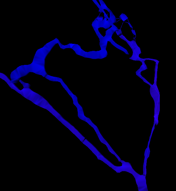
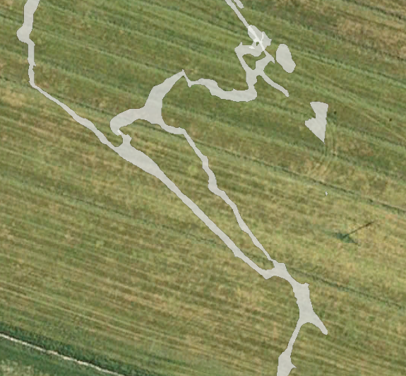
When drawing walls should the yellow 'tick' be on the inside or out?

Possibly more important, does it make a difference, all me pdfs are
fine, but I have a problem with the kml.

Which leads to a question when is a space between passages a pillar? If
this 'pillar' is defined over many survey trips and multiple scraps, is
the only solution to use -outline in option? Which leads to a further
question, what happens if I would like to produce output with one of the
passages not included, ie not publish the picture to the whole world
before giving a lecture at a conference.

The scenario is illustrated by the 2 attached images. The model shows
what it should look like, the other is the kml on google earth with the
passage on the right missing. Is the only way to get this to work as a
kml, to define all the inside walls as outline in?

thanks in advance for the help

Andrew

PS If anyone is interested, all the help received has produced this
output (8Mb)

http://www.ubss.org.uk/resources/surveys/survex/Charterhouse.lox

Lots of the 'smearing' is from made up surveys, constructed from old plans.

More project information available on

http://www.ubss.org.uk/cave_survey_archive.php
-------------- next part --------------
A non-text attachment was scrubbed...
Name: Model.png
Type: image/png
Size: 52720 bytes
Desc: not available
URL:
<http://mailman.speleo.sk/pipermail/therion/attachments/20100622/03147b99/attachment.png>
-------------- next part --------------
A non-text attachment was scrubbed...
Name: kml.png
Type: image/png
Size: 451820 bytes
Desc: not available
URL:
<http://mailman.speleo.sk/pipermail/therion/attachments/20100622/03147b99/attachment-0001.png>