 Stan Stockton wrote:
>>> Specifically what I want to find out is how much louder I would likely be
>>> in Europe from 25 degrees to 50 degrees if the vertical was on that line
>>> you drew as compared to being 70 feet below the line.
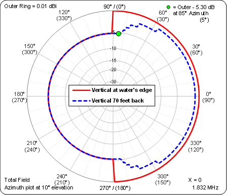
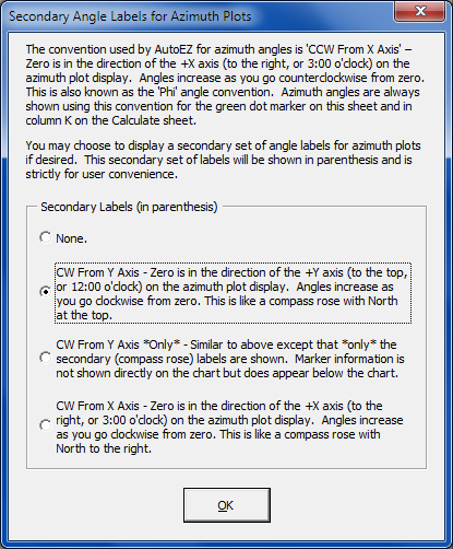
>>> Can AutoEZ be used to model this?

Yes, but only assuming that the water's edge is a straight line parallel to the
Y axis. Here's a comparison of the azimuth patterns at a 10° elevation angle
when a) the vertical is right at the water's edge and b) the vertical is 70
feet back from the water. Land is to the left of the Y axis and water is to the
right.

https://i.postimg.cc/j5RDRMGz/image.png

The green dot marker is at 5° "into the water" since the water's edge is along
the up/down Y axis. At that azimuth there is a 5.3 dB advantage to having the
vertical at the water's edge. In contrast, looking straight out over the water
(along the X axis) the advantage of being at the edge is only 0.8 dB.

In the image above, a second set of azimuth ring labels (in parenthesis) has
been added. This "compass rose" set of labels will help to mentally rotate the
entire chart such that the water's edge (the Y axis) aligns with your physical
location. Here's another image explaining that second set of labels.

https://i.postimg.cc/zfrBkdD9/image.png

Dan, AC6LA
_________________
Searchable Archives: http://www.contesting.com/_topband - Topband Reflector