Hi,

i am thinking there's a lack of OSM editors to be used on the road. Something
simple
allowing to e.g. set nodes while on the road etc. Just for all those things
that aren't
easily derived from the gps track.
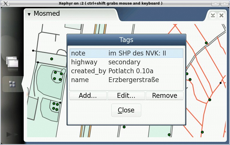
So i started Mosmed (Mobile OSM EDitor, and yes, in the meantime i've learned
that
there's something named mosme which is the same thing targetted at windows ce).
The name is only for development and may change (any idea is welcome).

Here's what i am trying to do:
- Simple gui, currently the map looks quite exactly as it does in potlatch
- Work is handled in projects (basically an area you work on for which the osm
data is then
  downloaded) to keep the data to be handled small
- support for GPS and live overlayed tracks
- stylus/touchscreen control
- direct OSM interface

I am doing this using a bunch of exisiting frameworks on top of
maemo/gtk/hildon so
this runs on the nokia internet tablets as well as on gtk equipped desktops
(linux). The
drawing is e.g. done using gnomecanvas which gives nice antialiased vector
graphics
as seen on this (rather old) snapshot here:

  http://www.harbaum.org/till/maemo/mosmed.jpg

Mosmed also did its first upload to the database (the tags of node 283749903
have been
changed using mosmed).

I really think there's a need for something like this. The built-in gps of the
nokia n810 in
combination with its wlan/bluetooth for osm up- and download and the 800x480
scree
imho make this a very nice device to be used for live updates on the road.

Regards,
  Till


_______________________________________________
dev mailing list
dev@openstreetmap.org
http://lists.openstreetmap.org/listinfo/dev