John Denker wrote:

> Here's another fun way of mapping airspace:  You can get sectional
> charts in the form of .tif files from:
>
> http://www.aeronav.faa.gov/index.asp?xml=aeronav/applications/VFR/chartlist_sect
[...]
> This is a low priority for me, because I am content to
> reproject all rasters to a common SRS using gdalwarp.  That
> does everything I need it to do.
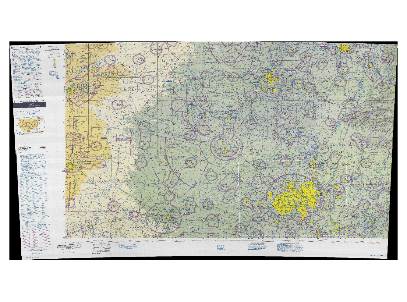
BTW, as a quick script-fun-project I've reprojected these maps into WGS84,
but as you can see from this QGIS screenshot:

  http://foxtrot.mgras.net/bitmap/Dallas-Ft_Worth_87_WGS84.png

....  there's still a lot of work to be done for clipping off the
legends, which, obviously, has to be performed _before_ re-projecting,
before you'll be able to create a seamless map of the entire US.

Cheers,
        Martin.
--
 Unix _IS_ user friendly - it's just selective about who its friends are !
--------------------------------------------------------------------------

------------------------------------------------------------------------------
All the data continuously generated in your IT infrastructure contains a
definitive record of customers, application performance, security
threats, fraudulent activity and more. Splunk takes this data and makes
sense of it. Business sense. IT sense. Common sense.
http://p.sf.net/sfu/splunk-d2dcopy1
_______________________________________________
Flightgear-devel mailing list
Flightgear-devel@lists.sourceforge.net
https://lists.sourceforge.net/lists/listinfo/flightgear-devel