Just found a better image to illustrate a ditch:
http://www.woodrow.org/teachers/esi/2001/CostaRica/palo_verde1/human-altered/images/ditch2.jpg
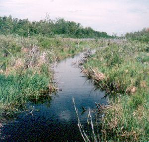
Tristan

2008/9/1 Tristan Scott <[EMAIL PROTECTED]>:
> the Waterway=Drain tag has this description:
> A Drain is an artificial waterway used for carrying storm water or
> industrial discharge.
>
> To me, that seems unrelated to the ditches I have in mind:
> they don't carry storm water - normally the water table won't move
> much in a storm (at least in the UK) and the ditches stay were they
> are. They contain natural rainwater or saltwater from the marshes.
> Secondly, they don't really drain so much as just sit there - the
> fields around stay wet, the water doesn't really move. They're used as
> fences as much as somewhere to connect field drains to.
> here's a pic that seems to illustrate what i have in mind:
> http://web.ncf.ca/bf250/images/odditch.jpg
>
> It strikes me that tagging as drain loses the information that drains
> are usually empty unless draining something (like a storm) and also
> tend to be channels for water movement rather than just sort of long
> thin ponds, though I suppose we must lose information somewhere to
> avoid tag congestion.
> Maybe modifying and clarifying the scope of the drain tag would do?
> Thoughts?
>
> Tristan
>
> 2008/9/1 Andy Robinson (blackadder-lists) <[EMAIL PROTECTED]>:
>> Tristan Scott wrote:
>>>Sent: 01 September 2008 3:37 PM
>>>To: talk@openstreetmap.org
>>>Subject: [OSM-talk] [tagging] Feature Proposal - RFC - waterways/ditch
>>>
>>>This is a request for comments (my first, so let me know if i've done
>>>it wrong!) on my waterway/ditch.
>>>http://wiki.openstreetmap.org/index.php/Proposed_features/Ditch
>>>
>>>mainly as there's a large area of marshes around where I live, and the
>>>canal waterway tag is completely inappropriate for the still overgrown
>>>drainage ditches (too wide to jump, too overgrown and narrow to
>>>navigate, and not even remotely canal-like)
>>>I can get organised with a picture of the ditch if that's necessary.
>>>Note that ditchs are occasionally "slubbed" out, but every ditch i
>>>know of is more than 50 years old - so it's not as if they're
>>>seasonal.
>>>
>>>oh, and they're on Ordnance Survey maps as thin blue lines, if that's
>>>relevant.
>>
>> Map Features has always had a waterway=drain tag which was always intended
>> for drains and ditches. I've been using that when I come across one.
>>
>> Cheers
>>
>> Andy
>>
>>
>>
>
>
>
> --
> Tristan Scott BSc(Hons)
> Yare Valley Technical Services
> 01603 858441
> 07837 205829
>


--
Tristan Scott BSc(Hons)
Yare Valley Technical Services
01603 858441
07837 205829

_______________________________________________
talk mailing list
talk@openstreetmap.org
http://lists.openstreetmap.org/listinfo/talk