Joe,

What tracking program is that?
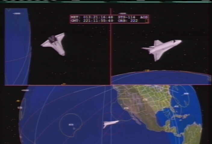
I was thinking of making my satellite icons configurable.  This way the
satellite would look like the actual satellite.  Even better, I could store
collada models for them and load them in place of the icon.  Oh la la, that's
an idea.

Joseph Armbruster


On Mar 26, 2013, at 7:58 AM, Joe Fitzgerald wrote:

> On 3/25/2013 6:42 PM, Ken Ernandes wrote:
>> 2.  If you decide to give the users the ability to input their location,
>> them the option to provide either a single minimum elevation angle or a
>> local map -- i.e., 360 individual minimum elevations as a function of
>> Azimuth.  It's much easier to project this and the user is generally
>> interested in an unobstructed LOS with respect to his/her location.
>>
>>
>
> It's not the best resolution but in the image below, you can see how there
> are "cut outs" in the circles surrounding NASA's ground stations - the
> software has clearly implemented the idea Ken outlined above.  For example,
> there is apparently some obstruction to the south east of the Hawaiian
> tracking station.  If the sub-satelite point is inside the white line it's
> AOS.  The surface of the earth visible to the shuttle, on the other hand, is
> simply a red circle, just faintly visible in this image.
>
> http://vault.newsfromspace.com/missions/sts114/STS114_land-5.jpg
>
> -Joe KM1P
> _______________________________________________
> Sent via [email protected]. Opinions expressed are those of the author.
> Not an AMSAT-NA member? Join now to support the amateur satellite program!
> Subscription settings: http://amsat.org/mailman/listinfo/amsat-bb


_______________________________________________
Sent via [email protected]. Opinions expressed are those of the author.
Not an AMSAT-NA member? Join now to support the amateur satellite program!
Subscription settings: http://amsat.org/mailman/listinfo/amsat-bb