It's a very spiffy picture isn't it Andrew.
I have a small copy as my windows background at the moment.
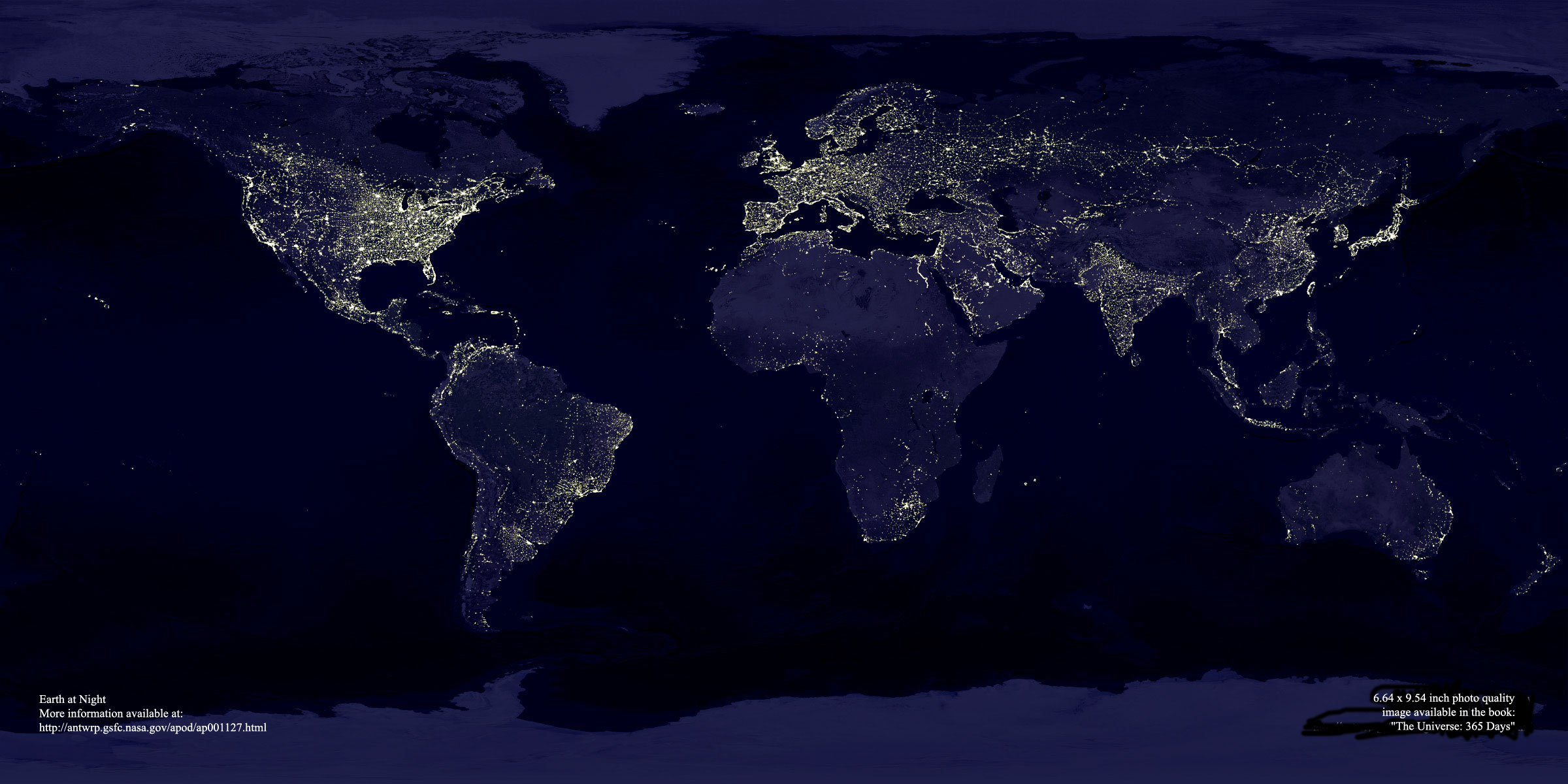
But what it really is :
A composite picture of earth with false colours. Taken by the satellites of
the US Defence Meteorological Satellite Program (hence DMSP in the file
name). I would guess it is based on infra red radiation (not visible light)
that's why no clouds appear in the pic (below para from
http://samadhi.jpl.nasa.gov/msl/Programs/dmsp.html hints that the satellites
see through cloud).
The DMSP program provides weather monitoring for the military. Information
from the satellites is used for general weather predictions, as well as for
severe weather warnings. One decidedly military application is the use of
DMSP data to save surveillance satellite film/observation time when targets
are obscured by clouds. Some information from the DMSP program is shared
with NOAA for use by the civilian community. Intially begun in 1965, over 35
DMSP satellites have been launched. The satellite bus and instrument payload
have been improved over the years resulting in 6 (?) different DMSP
variants. The satellites are operated in pairs to provide daily coverage of
the entire Earth, with high latitude areas receiving twice daily coverage
Regards
SWK
> -----Original Message-----
> From: ANDREW WRIGHT [SMTP:[EMAIL PROTECTED]]
> Sent: Friday, 23 February 2001 3:12
> Subject: [aus-soaring] Re: check this out---NASA photograph of earth
> at night
>
> Dear Gliding friends
> My head of department sent me this forwarded message for me to look at.
> I thought it might be of interest to all us gliding people.
>
>
> > >>out---NASA photograph of earth at night
>
Snip....
> > >>
> >http://antwrp.gsfc.nasa.gov/apod/image/0011/earthlights_dmsp_big.jpg
>
> Andrew Wright (VH GAM)
>
>
--
* You are subscribed to the aus-soaring mailing list.
* To Unsubscribe: send email to [EMAIL PROTECTED]
* with "unsubscribe aus-soaring" in the body of the message
* or with "help" in the body of the message for more information.