On Wed, Apr 6, 2016 at 10:02 PM, Justin Deoliveira <[email protected]>
wrote:
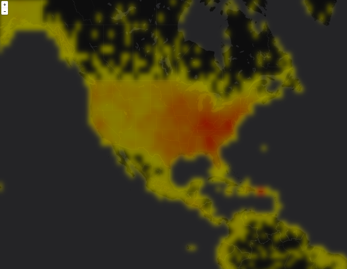
> Hi folks,
>
> I’m working on a project to expose Solr’s heatmap capability through
> GeoServer. You can find details about Solr heatmaps here:
>
>     https://cwiki.apache.org/confluence/display/solr/Spatial+Search (search
> for “Heatmap Faceting”.
>
> But the gist of it is this: If you have a spatial field that uses the
> recursive prefix tree type (ie. geohash) for indexing then it’s easy using
> Solr’s facetting infrastructure to generate a heatmap grid. What you get
> back from Solr is a 2D array representing the geohash grid, where each
> value is a count of documents that intersect that grid cell. Applying some
> symbolization you can get something that looks like this:
>
>
> https://raw.githubusercontent.com/voyagersearch/leaflet-solr-heatmap/master/sample.png
>
> The above screen shot comes from a leaflet plugin that visualizes the
> heatmap directly in the browser. I would like to add a similar looking
> visualization for GeoTools/GeoServer.
>
> My first thought was to expose this as a new type of coverage reader,
> since the data is simple grid it falls into the model quite easily. The
> major benefit of this approach is that becomes trivial to configure in
> GeoServer and easy to style using all of the existing raster symbology
> support. I’m interested to hear if others think this is a good approach.
>

I believe it is. You might want have a look at how the sde coverage reader
was setup, to share the same connection
info as a vector solr store (downside, you first have to setup a vector
store).


>
> If that sounds good my plan was to add this to the existing solr module.
> It won’t add any new dependencies aside from a dependency on the coverage
> module.
>
> @Andrea: you’re listed as the module maintainer… although if I recall
> correctly we agreed to co-maintain the module?
>

We did, just add yourself in the pom :-)


>
> I have a prototype working so if that all sounds good I’ll push up a
> branch for folks to look at.
>

Great


> One thing I am particular eager to get some feed back on is how to best
> achieve the blur affect that makes heatmaps look “
> pretty”. At the moment what I have done is baked in a parameter to the
> coverage format that specifies a blur radius and then when reading the
> coverage I run it through the Convolve operation to achieve the desired
> affect. It would be ideal if this could be done at symbolization time. I’m
> wondering if we currently have any way to define a blur or some similar
> effect at rendering time with sld? Would a rendering transform work?
>

I don't think we have a blur operation, a rendering transform would likely
do the trick with the smallest effort.
In an ideal world, it would be nice to have a FTS level vendor parameter to
perform blurring just like we do color composition
but I guess that might be more complex to implement.

Cheers
Andrea

--
==
GeoServer Professional Services from the experts! Visit
http://goo.gl/it488V for more information.
==

Ing. Andrea Aime
@geowolf
Technical Lead

GeoSolutions S.A.S.
Via di Montramito 3/A
55054  Massarosa (LU)
phone: +39 0584 962313
fax: +39 0584 1660272
mob: +39  339 8844549

http://www.geo-solutions.it
http://twitter.com/geosolutions_it

*AVVERTENZE AI SENSI DEL D.Lgs. 196/2003*

Le informazioni contenute in questo messaggio di posta elettronica e/o
nel/i file/s allegato/i sono da considerarsi strettamente riservate. Il
loro utilizzo è consentito esclusivamente al destinatario del messaggio,
per le finalità indicate nel messaggio stesso. Qualora riceviate questo
messaggio senza esserne il destinatario, Vi preghiamo cortesemente di
darcene notizia via e-mail e di procedere alla distruzione del messaggio
stesso, cancellandolo dal Vostro sistema. Conservare il messaggio stesso,
divulgarlo anche in parte, distribuirlo ad altri soggetti, copiarlo, od
utilizzarlo per finalità diverse, costituisce comportamento contrario ai
principi dettati dal D.Lgs. 196/2003.


The information in this message and/or attachments, is intended solely for
the attention and use of the named addressee(s) and may be confidential or
proprietary in nature or covered by the provisions of privacy act
(Legislative Decree June, 30 2003, no.196 - Italy's New Data Protection
Code).Any use not in accord with its purpose, any disclosure, reproduction,
copying, distribution, or either dissemination, either whole or partial, is
strictly forbidden except previous formal approval of the named
addressee(s). If you are not the intended recipient, please contact
immediately the sender by telephone, fax or e-mail and delete the
information in this message that has been received in error. The sender
does not give any warranty or accept liability as the content, accuracy or
completeness of sent messages and accepts no responsibility  for changes
made after they were sent or for other risks which arise as a result of
e-mail transmission, viruses, etc.

-------------------------------------------------------
------------------------------------------------------------------------------
_______________________________________________
GeoTools-Devel mailing list
[email protected]
https://lists.sourceforge.net/lists/listinfo/geotools-devel