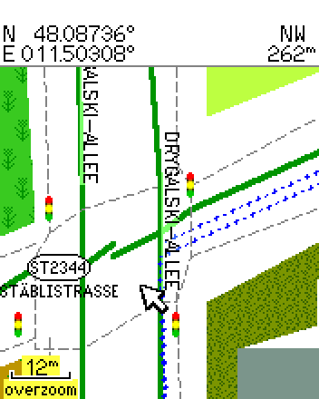
Hi!

One street shoes a gap that does not seem to be in the osm data:
http://www.deltadelta.de/nmz/sc21.png
vs.
http://www.openstreetmap.org/?lat=48.08617&lon=11.50167&zoom=17&layers=B000FTF
I tried to navigate to the "Bad Forstenrieder Park". Since one can not
pass this gap, the route went to Drygalski Allee, Herterichstr, then
right and then to the grade3 path through the farmland. But I used
car/motorcycle. What have I to put i which file so that routing goes not
across unpaved tracks?

TIA,
Dani

P.S: mkgmap 1597
_______________________________________________
mkgmap-dev mailing list
[email protected]
http://www.mkgmap.org.uk/mailman/listinfo/mkgmap-dev