Hi Daniela,

> Hi!
>
> One street shoes a gap that does not seem to be in the osm data:
> http://www.deltadelta.de/nmz/sc21.png
> vs.
> http://www.openstreetmap.org/?lat=48.08617&lon=11.50167&zoom=17&layers=B000FTF
>
> I tried to navigate to the "Bad Forstenrieder Park". Since one can not
> pass this gap, the route went to Drygalski Allee, Herterichstr, then
> right and then to the grade3 path through the farmland. But I used
> car/motorcycle. What have I to put i which file so that routing goes not
> across unpaved tracks?
>
> TIA,
> Dani
>
> P.S: mkgmap 1597
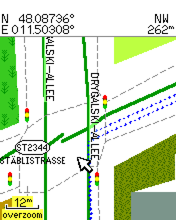
Hmm, can't explain that - see attached pic showing mapsource routing
through that junction  - mkgmap version 1598, current OSM data.

Cheers,

Mark
<<attachment: stablistrasse.png>>
_______________________________________________
mkgmap-dev mailing list
[email protected]
http://www.mkgmap.org.uk/mailman/listinfo/mkgmap-dev