FYI,

I already moved the tags to the multipolygon relation but the 2 poi
icons still exist:
http://www.openstreetmap.org/browse/relation/452620
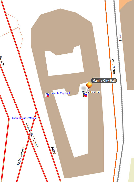
On Wed, Nov 17, 2010 at 7:16 PM, maning sambale
<[email protected]> wrote:
> This way is tagged as a amenity=townhall and a multipolygon relation:
> http://www.openstreetmap.org/browse/way/24159829
> http://www.openstreetmap.org/browse/relation/452620
>
> In my style:
> polygons:
> building=* | man_made=* | amenity=* | tourism=* [0x13 resolution 24]
>
> and in the points:
> amenity=townhall [0x3003 resolution 21]
> building=* [0x6402 resolution 24]
>
> I have the add-pois-areas switch enabled
>
> This resulted to two POI icons (the little PH flag) in garmin
> http://farm2.static.flickr.com/1290/5184379090_bbeeeaffc8_b.jpg
> --
> cheers,
> maning
> ------------------------------------------------------
> "Freedom is still the most radical idea of all" -N.Branden
> wiki: http://esambale.wikispaces.com/
> blog: http://epsg4253.wordpress.com/
> ------------------------------------------------------
>


--
cheers,
maning
------------------------------------------------------
"Freedom is still the most radical idea of all" -N.Branden
wiki: http://esambale.wikispaces.com/
blog: http://epsg4253.wordpress.com/
------------------------------------------------------
_______________________________________________
mkgmap-dev mailing list
[email protected]
http://www.mkgmap.org.uk/mailman/listinfo/mkgmap-dev