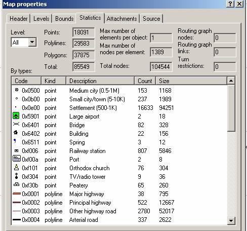
If you download gpsmapedit from www.geopainting.com, you can analyse all those
statistics in each img tile.
See http://magellan.ucoz.ru/image/article/27082010/image015.jpg
> yes, i think having some numbers per element-types & resolutions would
> be helpful.
>
>
> cheers,
>
>
> jose
_______________________________________________
mkgmap-dev mailing list
[email protected]
http://lists.mkgmap.org.uk/mailman/listinfo/mkgmap-dev