Hi Minko,

thanks for that hint. I think this is much better than a simple list.
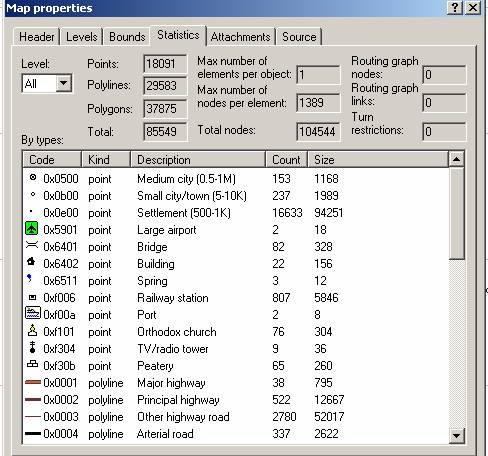
Gerd


Minko-2 wrote
> If you download gpsmapedit from www.geopainting.com, you can analyse all
> those statistics in each img tile.
> See http://magellan.ucoz.ru/image/article/27082010/image015.jpg
>
>> yes, i think having some numbers per element-types & resolutions would
>> be helpful.
>>
>>
>> cheers,
>>
>>
>> jose
> _______________________________________________
> mkgmap-dev mailing list

> [email protected]

> http://lists.mkgmap.org.uk/mailman/listinfo/mkgmap-dev


--
View this message in context:
http://gis.19327.n5.nabble.com/reducing-output-map-size-tp5759357p5759390.html
Sent from the Mkgmap Development mailing list archive at Nabble.com.
_______________________________________________
mkgmap-dev mailing list
[email protected]
http://lists.mkgmap.org.uk/mailman/listinfo/mkgmap-dev