The one I saw the other day was a reasonably long loop road. It would
expect it to either be maintained by the Local Authority or the Housing
Association, but even if it was a non-adopted highway I'm not sure how this
would change my tagging??
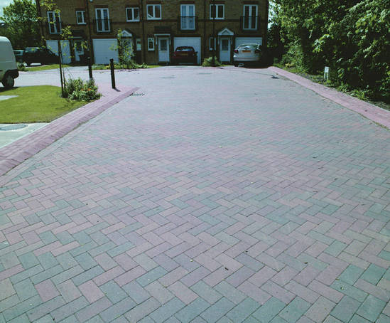
Shared access driveways were tarmac in this development. I usually tag
these are highway=service or not map them at all (in cases where they are
short, and I am only using GPS data as no aerial imagery is available).

Rob


On 31 August 2014 13:30, SK53 <[email protected]> wrote:

> Hi Rob,
>
> I know others have mapped as in your first suggestion, but I'm strongly in
> favour of the second. Living Streets have particular regulations whereas
> modern estate roads (usually cul-de-sacs) do not.
>
> It is sometimes worth ascertaining if the block-paved sections are adopted
> highways, where they only occur at the ends of streets. In some cases these
> may just be a shared-access driveway. Not always easy to do of course.
>
> Jerry
>
>
> On 31 August 2014 12:51, Rob Nickerson <[email protected]> wrote:
>
>> Hi all,
>>
>> I've see an increased use of block paving as a road surface on new
>> housing developments. Example image:
>>
>> http://cms.esi.info/Media/productImages/38030_1338993270237_PF.jpg
>>
>> How are people tagging these? At first I wondered about the
>> highway=living_street tag but the wiki page suggests these should be
>> signposted and have special regulations:
>>
>> http://wiki.openstreetmap.org/wiki/Tag:highway=living_street
>>
>> I guess highway=residential and surface=paving_stones is most suitable
>> unless someone has some better suggestions?
>>
>> Regards,
>> Rob
>>
>> _______________________________________________
>> Talk-GB mailing list
>> [email protected]
>> https://lists.openstreetmap.org/listinfo/talk-gb
>>
>>
>
_______________________________________________
Talk-GB mailing list
[email protected]
https://lists.openstreetmap.org/listinfo/talk-gb