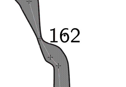
I'm trying to put "altitude" points into my map.  I've used point altitude
successfully, but the number over-writes the cave.  I've found I can move
the point outside the cave outline, and it still reports the correct
altitude, but it the "dot" appears now outside the cave, of course, as
attached.
Is there a way of specifying the position of the altitude "point" within the
cave passage, but moving the text outside?  I could do this manually of
course with a point label, but then the altitude data would not be computed
from the centreline, so not ideal.


Can anyone advise me on this one?
- Ben


-------------- next part --------------
An HTML attachment was scrubbed...
URL:
<http://mailman.speleo.sk/pipermail/therion/attachments/20080506/0589826c/attachment.html>
-------------- next part --------------
A non-text attachment was scrubbed...
Name: image001.gif
Type: image/gif
Size: 6789 bytes
Desc: not available
URL:
<http://mailman.speleo.sk/pipermail/therion/attachments/20080506/0589826c/attachment.gif>