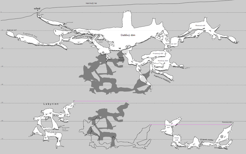
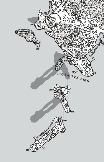
12. 11. 2014 v 19:37, Bruce <bruce at tomo.co.nz>:

> Have you though of using offset in your extended elevations as an alternative
> to segregated output files? You know you can choose the starting station and
> direction of branching in extended elevations?
> You can use offset to separate passages that would otherwise overlie each
> other.  This would give you segregated maps in a single file/run and the
> relationship of the offset maps can be displayed by Therion in the form of
> map-connection lines and preview above/below outlines.
-------------- next part --------------
An HTML attachment was scrubbed...
URL:
<http://mailman.speleo.sk/pipermail/therion/attachments/20141112/1eea6c99/attachment.html>
-------------- next part --------------
A non-text attachment was scrubbed...
Name: Sn?mek obrazovky 2014-11-12 v?20.37.41.png
Type: image/png
Size: 176274 bytes
Desc: not available
URL:
<http://mailman.speleo.sk/pipermail/therion/attachments/20141112/1eea6c99/attachment.png>
-------------- next part --------------
A non-text attachment was scrubbed...
Name: Sn?mek obrazovky 2014-11-12 v?20.39.16.png
Type: image/png
Size: 115728 bytes
Desc: not available
URL:
<http://mailman.speleo.sk/pipermail/therion/attachments/20141112/1eea6c99/attachment-0001.png>