> I cannot get preview/offsets to work for projected elevations, should

they, the thbooks seems to say any map!!
So yes, I checked a projected elevation.

Both offset and preview work OK, just like plan projections.

The difficulty I recalled may have been associated with 'map-level'.


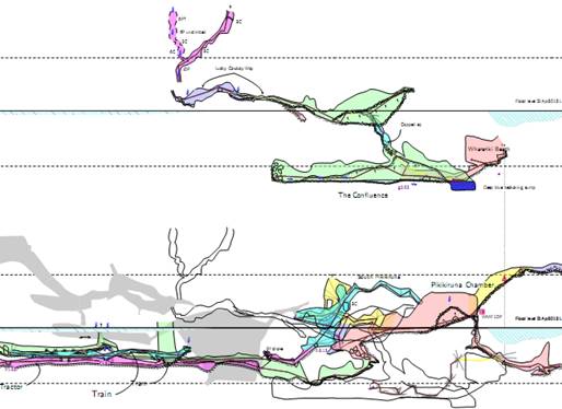
In the diagram below, the shaded passage is 'preview below', and the outline
is 'offset 100m above'.


The definition is like this.

map AblutionInceptionElev020Map \

  -title "Greenlink System Elevation looking 020 deg" \

  -projection [elevation 020 deg]


   #in front

   JM-DigiPlusElev020 at MiddleEarth [000 100 m] above

   IK-LuckyCowboyElev020 at MiddleEarth [000 100 m] above

   break

   JG-TrainElev020 at MiddleEarth

   .

   break

   preview below IJ-CarpeDiemElev020 at MiddleEarth

   .

endmap


and in the th-config the map is invoked directly with


   select AblutionInceptionElev020Map


Hope that helps

Bruce


-------------- next part --------------
An HTML attachment was scrubbed...
URL:
<http://mailman.speleo.sk/pipermail/therion/attachments/20150712/be65a850/attachment.html>
-------------- next part --------------
A non-text attachment was scrubbed...
Name: image002.jpg
Type: image/jpeg
Size: 30082 bytes
Desc: image002.jpg
URL:
<http://mailman.speleo.sk/pipermail/therion/attachments/20150712/be65a850/attachment.jpg>