Hello,

> Anyway, I am going to give this also a shot and contact some companies
> that provide aerial/satellite image data, could anybody here provide the
> details concerning the requirements that need to be met for an image
> to be suitable to be used as a texture for FlightGear ?
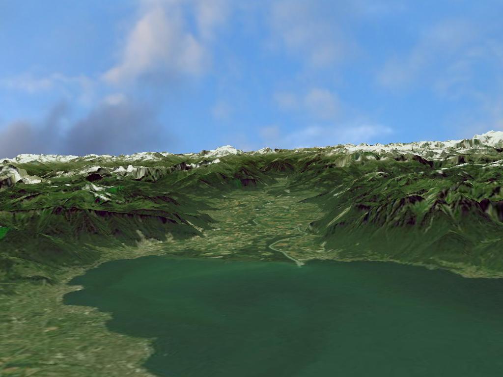
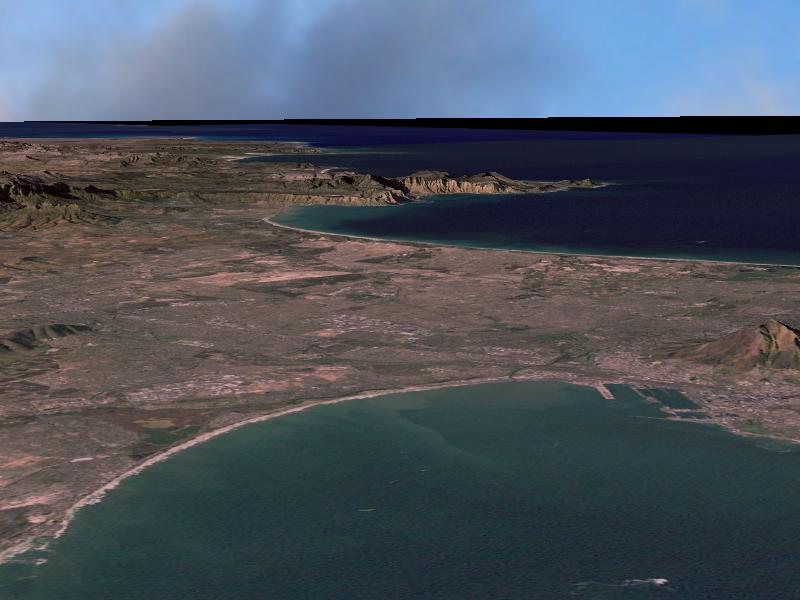
I've been lurking on this list for some time ( => pilot-wannabe :-) ), and as
the question for more accurate or more realistic scenery seems to be quite
recurrent, I'd like to present you our little terrain rendering project at the
University of Bonn (see [1]). Unfortunately, we do not have a very informative
webpage up yet, but you can download some old demo videos and a paper
describing the algorithms involved.

As part of the project, we have developed a terrain rendering engine which we
will probably release under the GPL (or similar) in the near future, and I
would be willing and interested to do some work on integrating it with
flightgear. Please tell me what you think. To give you an overview, the main
features  of the engine are:

- out-of-core rendering of large datasets in realtime
- LOD approach with one pixel accuracy regarding geometry, shading and
  textures
- compressed textures and geometry
- per-pixel normal map shading
- occlusion culling
- implemented in C++ / OpenGL
- currently runs under linux and win32

We are also currently building datasets out of the publically available
LandSat ETM true-color (28.5 m resolution) and SRTM-3 elevation data (~90 m
resolution) [2],  which both have almost worldwide coverage. It probably would
be a good idea to integrate more accurate textures (if available) near
airports, or to add procedural details for low-altitude flights.

To see what detail to expect from these Landsat datasets, here a few
screenshots of the Alps / Rh�ne valley + Lake Geneva,  Corsica, and Cap Of
Good Hope.

[Rhone valley] http://terrain.warped-space.de/rhonetal-lacleman.jpg
[Corsica] http://terrain.warped-space.de/corsica.jpg
[Cap Of Good Hope] http://terrain.warped-space.de/capetown.jpg

To give you an idea, such a dataset including textures, normal maps and
geometry for a single UTM zone (see [3]) is about 250 MB in size. Geometry
size is negligible at about 5 MB per UTM tile, the corresponding normal maps
eat away about 60 MB, the rest is used by textures. The engine can also handle
higher resolution datasets, but they're not as easily and consistently
available for such a global setting (nor is it practical looking at the amount
of data), so adding localized detail is probably a good solution.

There would still be a fair amount of work left to integrate such an engine
into flightgear, even after the release of the engine, but given enough
interest, I'd like to work on the remaining issues (I guess on the flightgear
side e.g. defining and implementing a more loosely coupled API for the terrain
subsystem;  scenery creation toolchain etc.).

Please tell me if that sounds interesting / useable!

bye,

 Manuel

----
[1] http://cg.cs.uni-bonn.de/projects/project.asp?id=10&language=en
[2] http://glcf.umiacs.umd.edu/index.shtml
[3] http://www.dmap.co.uk/utmworld.htm

_______________________________________________
Flightgear-devel mailing list
[EMAIL PROTECTED]
http://mail.flightgear.org/mailman/listinfo/flightgear-devel
2f585eeea02e2c79d7b1d8c4963bae2d