Hi,

I committed the support to read new X-Plane 850 file format in
flightgear. That doesn't mean that airports will look different in
current scenery because TerraGear tools have not been updated yet, but
this is the first step to support the format.
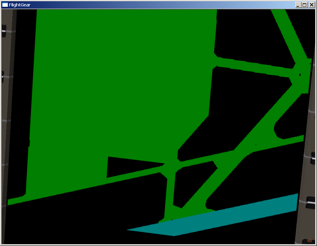
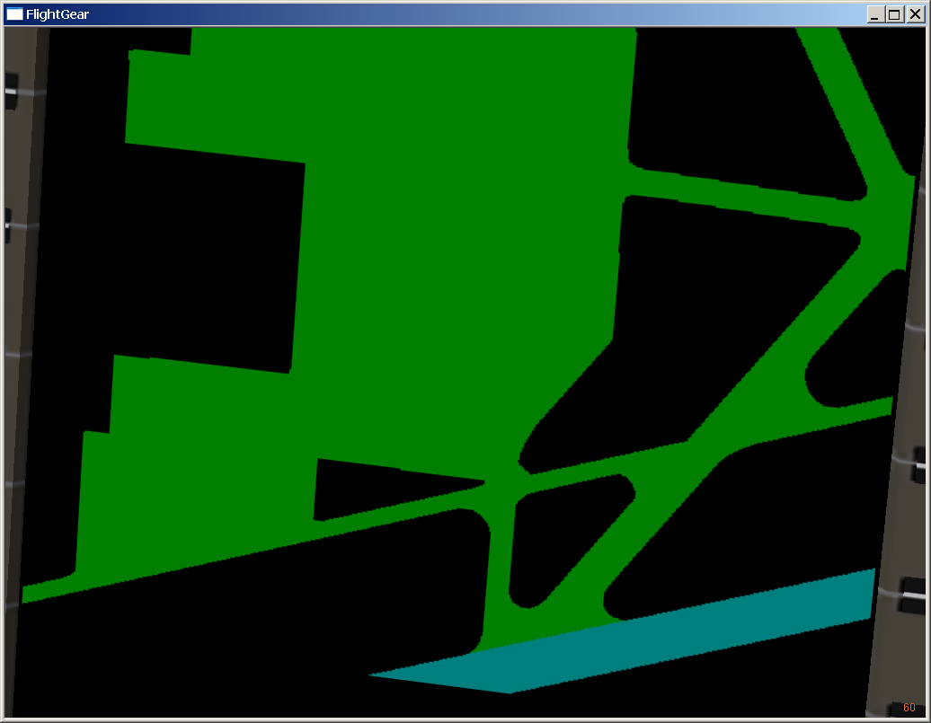
Here are two screenshots comparing the ground radar with the different
data :
http://frbouvi.free.fr/flightsim/KSBD-810.png
http://frbouvi.free.fr/flightsim/KSBD-850.png
The Google Maps link: http://tinyurl.com/n9khev
You should notice the smooth curves in the 850 screenshot.

The parser should read current data normally, and nobody should see the
difference until we change the data.

Please shout if you find something broken or overlooked. (actually
something is broken in the 777 ground radar, but it's not me ;-) )

Curt wrote (about linear features) :
> Fred, were you thinking of cutting these lines into the surface (with
> hard polygon edges) or drawing them over the top like with a
> glPolygonOffset() approach?  Or something else?  It would be really
> great to be able to add taxi lines and other markings to our airports.

I didn't really thought about it yet. I am open to ideas. Does the .btg
file format support the glPolygonOffset approach ?

Regards,
-Fred

--
Frédéric Bouvier
http://my.fotolia.com/frfoto/   Photo gallery
http://fgsd.sourceforge.net/    FlightGear Scenery Designer


------------------------------------------------------------------------------
Crystal Reports - New Free Runtime and 30 Day Trial
Check out the new simplified licensing option that enables unlimited
royalty-free distribution of the report engine for externally facing
server and web deployment.
http://p.sf.net/sfu/businessobjects
_______________________________________________
Flightgear-devel mailing list
[email protected]
https://lists.sourceforge.net/lists/listinfo/flightgear-devel