Curtis Olson wrote:

> Glad to see someone is starting to nibble at the 8.50 format and figure it
> out.  If you are developing code that takes the bezier outlines and can turn
> that into a polygon representation, then it shouldn't be terribly difficult
> to add that into genapts.
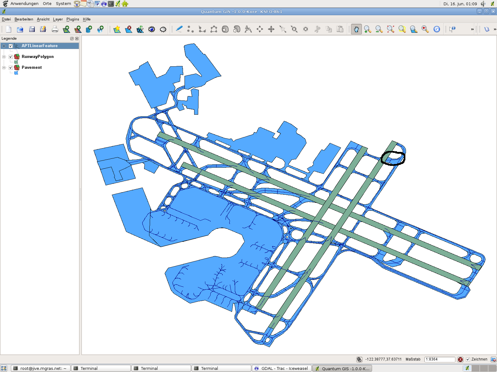
I'd like to remind that we are (I am) maintaining a complete set of
runways as well as taxiways/aprons at our repository known as
"Landcover-DB" as closed polygons with beziers properly cut into
smaller segments, merged together from v8.50 where available and v8.10
for the rest.
Different representations (distinct runway threshold positions for
example) or various combinations are available as well. These are
available for export into different formats like ESRI Shapefiles and a
lot more - please request if you think it might be useful for further
development.

If you load shapefiles into QGIS, it would, for example, look like this
shot:

  http://foxtrot.mgras.net/bitmap/FGFS/KSFO-861.png

Not that, as shown here, not all v8.50 airfields match the quality
measures we would expect - just take the northern part of taxiways L
(east of 19L) as an example. This doesn't mean that we should not go
for v8.50, I'm just trying to point out that we should consider
selecting carefully.

Cheers,
        Martin.
--
 Unix _IS_ user friendly - it's just selective about who its friends are !
--------------------------------------------------------------------------

------------------------------------------------------------------------------
Crystal Reports - New Free Runtime and 30 Day Trial
Check out the new simplified licensing option that enables unlimited
royalty-free distribution of the report engine for externally facing
server and web deployment.
http://p.sf.net/sfu/businessobjects
_______________________________________________
Flightgear-devel mailing list
[email protected]
https://lists.sourceforge.net/lists/listinfo/flightgear-devel