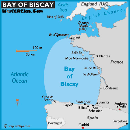
On Thu, Oct 30, 2014 at 08:41:18AM +0100, Marc Gemis wrote:
> Could we try an example to see whether mappers agree on bay areas ? could
> you draw the Gulf of Biscay on a map ?
>
> This guy did it :
> http://1.bp.blogspot.com/_-9_Y031ZiZQ/THowBMn81dI/AAAAAAAACi8/inSvDDa1DC4/s1600/Golf+van+Biskaje.jpg
>
> I might have extended it a bit further to the west on the Spanish coast...
note that the big bodies of water such as the bay of biscay have been "defined"
by the international hydropgraphic organization, wikipedia provides the link.

Those definitions should be probably mapped, but most likely with a special tag
rather than our natural=bay because their definition of gulf of mexico is
obviously
not compatible with our definition of bay (refering to the sentence fragment
"in Cuba,
through this island to the meridian of 83°W" which includes a landmas to the
definition)

Richard

_______________________________________________
Tagging mailing list
[email protected]
https://lists.openstreetmap.org/listinfo/tagging